Thursday, May 5, 2011
Monitoring Potential Severe Weather Outbreak May 8-10 (Issued May 5)
The Storm Prediction Center has outlined areas for a severe weather outbreak quite a days off.
For 3-4 days away, the SPC has outlined portions of Oklahoma, Kansas and Texas for a severe threat. For 5 days away, Those areas are enhanced with the severe threat.
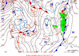
In order to see what will induce the severe threat, I have matched weather graphics for the time periods mentioned.
3 DAYS AWAY (Day 4 in the above graphic)
Day 4 severe weather risk begins with a stalled dry line, which will be productive for storms.
4 DAYS AWAY (DAY 5 on the graphic at the top of the page)
The dryline has stalled, continuing to produce storms in the same area.
5 DAYS AWAY (Day 6 at the top of the graphic)
A cold front presses the dryline to move along and widens the severe weather risk.
We will keep an eye on this developing event.
Tornado Warnings will be issued as needed.
Subscribe to:
Posts (Atom)


