Tuesday, November 23, 2010

11/23 SNOWcast

This is a SNOWcast for November 23rd.

At this time...a storm system is moving through the US.

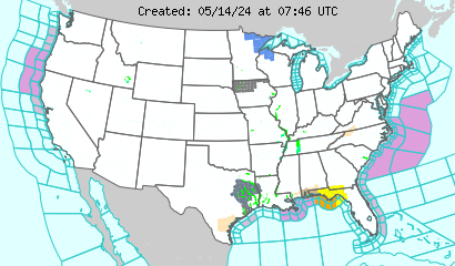
It has put up Winter Weather Watches, Winter Weather Warnings, Blizzard Warnings.

For more Info, go to www.weather.gov

Current Winter Warnings (Dark blue, Pink, Orange/red)

11/30 Potent Lower Great Lakes Snow Bulletin.

Good afternoon everyone! It's getting close to Turkey Day!

Anyway, I just ran the GFS for the first time in a couple days. On November 30th, I would not be surprised to see some snow flurries.

They would come in the wake of a cold front forecast to come through very soon.

More updates as more information comes in.

Sunday, November 21, 2010

Potential Great Lakes Snow Update #10

If the thickness were lower, the Lower Great Lakes would be in for a very nice snow.

Now, it looks like rain.

Potential Great Lakes Snow Update #9

This is an urgent update.

According to the GFS model, the November 23rd event will be 2 waves of rain and maybe an embedded t-storm.

More urgent, is the November 25th. Thickness will be ABOVE the max level required for snow. Meaning, RAIN SHOULD FALL. However, there are more factors than just that.

The likely scenario will be rain turning to snow by night. However, there is a chance that this will be a rain event with only a couple ice pellets in between if the environment is not sufficient for snow.