Haven't posted today, and i am sorry about that.
I was running over a few tests and studying some material I can hopefully bring in here as the hurricane season begins to open its doors.
Andrew
Friday, April 20, 2012
Thursday, April 19, 2012
May Outlook Release Date
The May forecast outlook will be issued Thursday, April 26, which will be the 2 year anniversary of The Weather Centre. Hard to believe it's been 2 years already.
-Andrew
-Andrew
Don't Count Off ECMWF Megastorm for Northeast Just Yet
The ECMWF has been calling for a strong storm system to bash the East Coast, potentially delivering snowfall in excess of 1 foot in much of the Northeast. Many have been throwing this out the window as the GFS takes a seemingly more sensible solution and goes out to sea. Let's review some things about the ECMWF and GFS' bad blood.
•Historically, the ECMWF is the 'better' model.
•The ECMWF correctly predicted the 2011 October snowstorm.
•The ECMWF was the 1st model to catch onto the idea of what become the 2011 Groundhog Day Blizzard (Source).
•The GFS is run 4 times a day, while the ECMWF is run twice.
•The ECMWF is based overseas in Europe.
For those wondering how I determined the ECMWF is historically the 'better' model, take a look below.
This is a combination of the latest GFS and ECMWF verification scores for the past many many runs over the Northern Hemisphere (20 N - 80 N). As you can see, the ECMWF has much better verification scores over the past several days, while the GFS lags behind with at least 4 runs highlighted in red, indicating unusually low verification scores.
Now, whether this storm happens remains to be seen. But I personally find it awfully convincing with the ECMWF/ECMWF Ensembles lined up for a strong storm system for the Northeast against the less-dominant GFS.
•Historically, the ECMWF is the 'better' model.
•The ECMWF correctly predicted the 2011 October snowstorm.
•The ECMWF was the 1st model to catch onto the idea of what become the 2011 Groundhog Day Blizzard (Source).
•The GFS is run 4 times a day, while the ECMWF is run twice.
•The ECMWF is based overseas in Europe.
For those wondering how I determined the ECMWF is historically the 'better' model, take a look below.
This is a combination of the latest GFS and ECMWF verification scores for the past many many runs over the Northern Hemisphere (20 N - 80 N). As you can see, the ECMWF has much better verification scores over the past several days, while the GFS lags behind with at least 4 runs highlighted in red, indicating unusually low verification scores.
Now, whether this storm happens remains to be seen. But I personally find it awfully convincing with the ECMWF/ECMWF Ensembles lined up for a strong storm system for the Northeast against the less-dominant GFS.
Wednesday, April 18, 2012
Late Season Snow for Northeast Possible Next Week
![]() |
| http://clients.customweather.com/plot_images/client_sites/WEATHERBELL /GFS/final_WB013/WB013_500_GPM_VOR_WIND_HOUR_K_50.png |
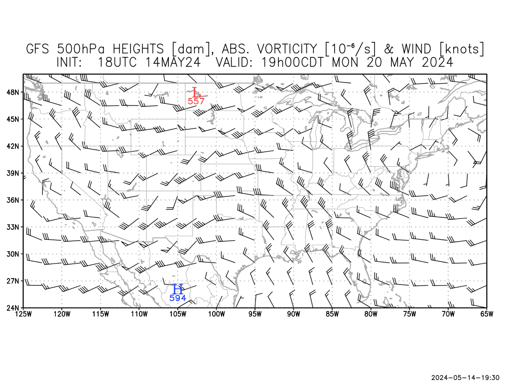
A caveat of this potential snowfall includes a crashing PNA index. The Pacific North American pattern, commonly referred to as the PNA, looks to be moving towards a negative phase around the time of the storm system. When the PNA is in a negative phase, a ridge is pressed into the Southeast and diverts storms away from the Northeast. Snowfall producing storms are favored in positive PNA situations. If this PNA forecast were to verify (which I am not completely sold on yet), the system would likely be forced away.
Something I would watch for is the NAO to help this storm. Seeing as it is being forecast into a negative phase, the North Atlantic Oscillation (NAO) would position variables to become conductive for a snowfall in the Northeast. I advise you not to totally take the NAO and run, because if you see the correlation with observations in the 14 day forecast on the bottom, there is only a 12% verification score in the past 4 months or so. Notice the glitch just before January 1. This likely battered down the score, so I would place the verification around 30%- still not very good.
Other Positives
•ECMWF/GFS model agreement is reassuring.
•NAO appears favorable for some light snow.
Other Caveats
•PNA must be considered.
•System remains 6-7 days out.
Tuesday, April 17, 2012
Strong Storm System May Ignite Active Weather Next Week
The image shown above is the 500mb height forecasts for 'Day 7', roughly a week out. At the 500mb level, one can detect low pressure systems when the lines are depressed into an upside-down arch. Ridges of high pressure are indicated in right side up arch formations.
In this forecast, made by the NCEP Superensemble, we see a very strong storm system swinging south which will likely shift into the Southeast. The ridge in place over the Central US will be shifted east or north with the invasion of this storm system.
I am worried about this right off the bat, considering that this strong a storm system will most likely latch onto the jet stream and stress it to increase wind speeds. Humid and warm air will boost instability in a scenario seen all too much this spring.
We have yet to see if this will verify, but the ensembles are very interested.
Andrew
In this forecast, made by the NCEP Superensemble, we see a very strong storm system swinging south which will likely shift into the Southeast. The ridge in place over the Central US will be shifted east or north with the invasion of this storm system.
I am worried about this right off the bat, considering that this strong a storm system will most likely latch onto the jet stream and stress it to increase wind speeds. Humid and warm air will boost instability in a scenario seen all too much this spring.
We have yet to see if this will verify, but the ensembles are very interested.
Andrew
Subscribe to:
Posts (Atom)


.png)