Showing posts with label Invest 93L. Show all posts

Wednesday, August 31, 2011

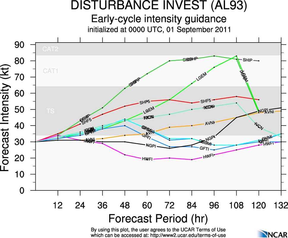
0z Invest 93L Full Ensemble Tracks and Intensity Forecasts in Gulf of Mexico


Invest 93L's development chances upped to 60% in Gulf of Mexico

The chances of Invest 93L developing into a depression, storm or hurricane in the next 48 hours have increased to 60%, and that number is expected to climb rather quickly at some point soon as upper level winds become more favorable. As soon as that happens, we can expect that we will have 'Lee' on our hands in the Gulf of Mexico. Here's the latest update from the NHC.

We also have some early updates as of 8:00 pm EDT this evening on the invest, and here they are.

Gulf of Mexico could be in for Tropical Cyclone 'Lee' by week's end

The Gulf of Mexico could and likely will be in for tropical cyclone Lee. Before we go on, a tropical cyclone is not just a hurricane, but also a tropical storm or tropical depression. The term tropical cyclone is used loosely as such.
This invest will move into the Gulf and then develop into Tropical Storm Lee.
Ensembles are showing Lee has a wide variety of options. The models are not handling this invest well at this time. However, at this time, it is believed that the two main options are south into Mexico, or northeast into Mississippi and Alabama. There is still the other two options on the table, but these are based on consensus and thoughts of other meteorologists.
There is still a lot of time before Lee could develop, and we will keep you informed throughout.