Showing posts with label South Plains Heavy Rainfall. Show all posts

Friday, March 9, 2012

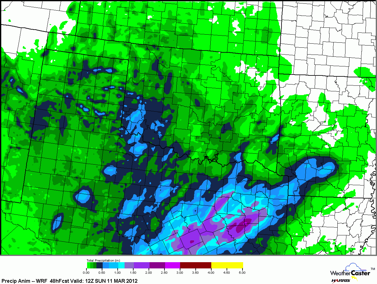
2.5 inches of rain expected for Texas in next 2 days

This special WRF 5km zoom 48-hour precipitation forecast is showing over 2.5 inches of rain forecast for east Texas.

This precipitation will come through as a storm system disturbs the atmosphere to make what the WRF is printing as scattered, high-precipitation storm cells.

Judging by a quick glance at the cells 3-hour precipitation, some of them will likely be able to put down some small hail and gusty winds.

-Andrew

Thursday, March 8, 2012

Long Range GFS Points to Stormy South

The latest long range GFS is pointing to a very wet and stormy South, with over 8 inches of precipitation forecasted in the next 16 days by the GFS. This high precipitation will come from a number of systems.

These high precipitation forecasts are not surprising, as the Alaskan Vortex currently in place will be sending a number of storm systems down the Northeast, into the Southwest where the systems will eject east into the South Plains and potentially cause some severe storms.

You cannot see the storm's precipitation in the Southwest because there is no Gulf Air to influence precipitation to fall in that area.

-Andrew