Showing posts with label Gulf of Alaska. Show all posts

Friday, February 21, 2014

Long Range Outlook: Late February, March 2014 Forecast

This post will detail the expected weather conditions for the end of February into most of the month of March, 2014.

We'll begin with the weather over the North Pacific and East Asia. Shown above is a previous ECMWF model forecast, showing 500mb height anomalies over the aforementioned regions. If we take a look over at Japan, we see some negative height anomalies present, valid on February 20th. If we use the idea that weather anomalies over East Asia can "re-appear" in the United States 6-10 days later, I would expect a stormy and cool weather pattern for the February 26-March 2nd period. But if we look just to the west, we see strong ridging behind that storminess in Japan.

We eventually see that ridging fill into Japan a couple of days later, as this 500mb height anomaly forecast from the most recent ECMWF forecast shows. With ridging expected to hit Japan on February 24th, a warm-up is probable for the March 2nd-6th period. It's worth watching for another storm threat, as we see a depression in the contour lines right over Japan that indicates the presence of a weak storm system. It is possible we see a storm drag warm air north from the Gulf of Mexico to set-up a severe weather threat, but that's all speculation at this point.

Following that initial warm-up in the first week of January, model guidance (the ECMWF Ensemble set, shown above here) wants to bring in a strong ridge of high pressure right over Japan. It looks like this ridge has the potential to bring some seriously warm air into the United States when we see the correlation kick in. With the graphic here valid for February 26th, look out for a warm, quiet weather pattern around the March 4th-8th time period. It's quite possible we see a sustained warm period from March 2nd to the 8th, if these ridges hold together.

Looking out to the last day of February we see the ECMWF bringing in a suppressed ridge into Japan. This tells us to look for that warm pattern to continue in the United States through the March 10th period. Remember to keep track of that Rossby Wave in Alaska, denoted by the powerful ridge.


The weather pattern will then do a flip in the second week of March, as model guidance sees the entrance of a strong trough into Japan on the 3rd day of next month, as the image here shows. This would likely see a return of cold and stormy weather somewhere in the March 9th-13th time period, as we use that 6-10 day gap between East Asian weather and United States weather.


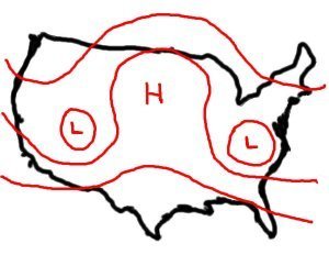
Moving out into the long-long range, we start to key in on the synoptic pattern, and not so much individual features like we were previously analyzing. We've got a good handle on the anticipated weather pattern for the first two weeks of March, so now we can begin forecasting the remainder of the month. This graphic shows you the predicted 500mb height anomalies over the Northern Hemisphere on March 8th. Note the ridging over the Arctic Circle indicating the presence of a negative Arctic Oscillation (-AO) phase, which heightens threats for cold weather in the lower latitudes (including the US). Also note the ridging starting to come back over the west coast of North America. This is part of the Rossby wave train, which is created when several rounds of strong high pressure are pumped poleward. In this case, the train has maintained itself over the northeast Pacific, at times shifting west into the waters just south of the Bering Sea. The way the pattern is aligned here, you'd be hard-pressed to not find a cold forecast for the Central and Eastern US. The flow across the Northern Hemisphere strongly favors a cold middle of March, with the Rossby Waves continuing to form and push northward along the West Coast, leading to cold weather for the populated areas out East. Since this is a 360 hour forecast, things will obviously change, but you get the idea: after the early March warm-up, additional cold weather is possible.


Why is all of this happening? The primary reason is the swath of above-normal sea surface temperature anomalies over the northeast Pacific, as this graphic shows. One of the best indicators of long-term weather patterns is sea surface temperatures. Apart from some sea surface temperature anomalies (SSTAs) defining various oscillations that also affect our weather, these swaths of above or below normal SSTAs correlate to positive or negative 500mb height anomalies, respectively. Thus, it's of little surprise that we are seeing strong ridging over the Northeast Pacific, where this big warm water mass resides. With the warm water still firmly entrenched in the waters south of Alaska, look for a cool spring to also be in store.

What we could end up seeing, if this warm pool becomes a long-term feature, is a northwest flow pattern for the spring season. The screenshot above, from a Storm Prediction Center publication, shows 500mb height contours in two different northwest flow situations, with the severe weather outbreak area circled. As you can see, severe weather events would be more prone to occurring further north during northwest flow severe weather outbreaks, and it's possible we see something like one of these situations evolve if that northeast Pacific warm pool continues to work its magic. I'll detail this more in my upcoming 2014 severe weather season outlook.

Andrew

Monday, December 2, 2013

December Looking Downright Frigid

Forecasts for a warm start to winter (mine included) are quickly being beat down with the emergence of new data in the long range. (Note, this post will deal with how December will average out to be frigid in parts of the country, not necessarily continuous cold weather.)

WeatherBell Models
European ensemble projections of 500 millibar geopotential height anomalies for the 10-12 day forecast timeframe have a strong ridge of high pressure evolving over the Bering Sea and beginning to shift westward. If true, this would lead to a couple of consequences.

First of all, it appears that a Rex Block might try to set up shop across eastern Russia and into East Asia. This forecast graphic above somewhat depicts that, with negative geopotential height anomalies forming across East Asia as that big ridge tries to progress west. At the same time as the ridge retrogrades west towards Russia, the persistent negative East Pacific Oscillation that has been prevailing across the Gulf of Alaska may actually reverse into a positive EPO, which would cut off our chances of this cold weather. This is to be anticipated, as the Bering Sea correlation of ridging on November 30th should result in some warmer weather in the US for a brief period, almost right in the middle of the month. Long range ensembles are already catching on to this idea, expanding the Southeast Ridge north, as the +EPO and +NAO aid in warm weather prospects. Beyond that, though, cold weather should return. Very long range ensembles indicate the ridge will shift east once again, which would kick out the +EPO and return the nation to a cooler pattern once again. 

The Madden Julian looks to lock in this warm-up in the middle of December, as it pushes into Phases 3 and 4 around December 8th through the 12th, roughly, as model guidance shows below.

November-December-January Phase 3 & 4 temperature composites on left
ECMWF MJO projection on right
After this mid-month warm up, the ridge should retrograde as the Phase 3 & 4 MJO dissipates. Interestingly enough, mid-level height composites for Phase 4 of the MJO in December actually favor deep negative height anomalies in the Gulf of Alaska, which would help push the ridge west towards Russia and enhance that positive East Pacific Oscillation chance. See how everything's interconnected here?

When the ridge retrogrades, expect the warm weather to dissipate and at least average, if not below average temperature anomalies spread out over the nation. If you take a look at that ECMWF ensemble guidance image at the top of this post again, you'll see that very stormy weather over East Asia like we previously discussed. With GFS ensembles in agreement, it does seem that the middle and latter portions of December will be rather stormy and cold in the United States as a result of that East Asian storminess. If you recall, weather in East Asia correlates with weather in the United States 6-10 days later. It's still a ways away, but if these stormy East Asian projections verify, I don't see why a resurgence of colder weather isn't possible. 

WeatherBell Models
Adding to this whole mix is the fact that the majority of what is referred to as the polar vortex will be over North America during this timeframe. As the ECMWF ensemble image above, valid for December 10th shows, two major ridges of high pressure will be stationed at key points across the upper latitudes. The aforementioned Bering Sea ridge will be meandering around the north Pacific, and another ridge in western Europe will be lending its hand to contain the polar vortex in North America. There is ridging in the Southeast, a result of deep negative height anomalies over Greenland (positive North Atlantic Oscillation), and this will keep the coldest weather in the West, Plains, and parts of the Midwest and Great Lakes for the most part. Intrusions further east are probable, but for consistent cold, the aforementioned regions are at the highest risk. 

The stratosphere may also try to play a role here, as I discussed in yesterday's post.

The stratosphere is telling us that the Central and East US may be in line for some very cold weather in the second half of December, and verification from its last cold weather indication says that we should be monitoring this development.

Between October 30 and the first few days of November, the Central and East US experienced above normal temperatures in the upper stratosphere. This is displayed well in the Climate Prediction Center's reanalysis of the 30th in the image above. These few days between the end of October and the start of November also included slightly above normal stratospheric temperatures diving south from Canada, with below normal temperatures observed in the Pacific Northwest. Because the effects of stratospheric warmings are typically seen 2-4 weeks after the warming event, we took a look at surface temperatures from November 14-28 to see how well the surface temperatures matched up with the upper stratospheric temperature anomalies (note that this is a negative correlation relationship, meaning above-normal stratospheric temperatures will lead to cold surface temperatures, and vice versa).

Ground-level temperature verification from November 14th to November 28th, approximately 2-4 weeks after the height of this US upper stratospheric warming event, is nearly identical to the temperature anomalies experienced in the stratosphere. The regions that saw above normal stratospheric temperatures, including the Central and East US, as well as Canada, saw below normal temperatures during this timeframe. Similarly, the Pacific Northwest, which was bathed in slightly below normal upper stratospheric temperatures to kick off November, was included in slightly above normal surface temperatures from November 14th to November 28th. It would seem to me that the stratosphere had a direct involvement with these surface temperature anomalies, given how well the stratospheric and surface temperature anomalies line up.

In the last few days, the upper stratosphere has suddenly sprang to life, with a wide swath of much above-normal temperature anomalies extending from as far west as the Rockies to the Eastern Seaboard, through the Atlantic Ocean and off to far western Europe. This would seem to hint at colder than normal weather making a return to the nation somewhere in the December 14-28 timeframe, roughly 2-4 weeks after yesterday (November 30th). Normally, I wouldn't be putting so much faith in the stratosphere to dictate temperatures for the next few weeks. However, with its stellar verification in the prior event, I'm willing to give this stronger warming event a shot. That said, I'm going along with this colder than normal prognosis for December 14-28 with low confidence, as there are a few other factors that may try and intervene to bring about warmer temperatures for this timeframe than what the stratosphere is suggesting. But until those come to fruition, I'll go ahead with the stratosphere's call for cooler temperatures between December 14th and 28th.

Let's summarize.
The beginning of December will be cold, as we have been anticipating for some time now. Around the middle of the month, a warm-up is expected, as the MJO, Bering Sea Rule and +EPO come into play. Then, as the MJO dies down, a colder weather pattern is expected to regain control as the East Asian correlation comes into play, the -EPO re-emerges, and any effects from the warming stratosphere propagate down to the surface. Averaged out, the month of December should end up very cold/frigid for many parts of the country.

Andrew

Tuesday, November 26, 2013

Long Range Lookout: Early-Mid December Looking Very Cold, Snowy

It's looking like early to mid December will be very cold, and quite possibly snowy across much of the nation.

Relative atmospheric angular momentum values for the last couple of months tell the story, as we have seen an emergence of positive AAM anomalies above the 60N latitude mark, as shown by the yellow blob near the top right part of the image. Without going into the technical aspect of the AAM, it is known that positive AAM anomalies above the 60N latitude line, with -AAM anomalies below that parallel can lead to favorable winter weather conditions across the country. In this case, a recent spike in AAM anomalies across the upper latitudes is now leading to the emergence of ridging near the Arctic, as I will show later on in this post. The -AAM anomalies persist across the mid-latitudes, confirming the suspicion that wintry weather will be here to stay for a little while.

Image created by Nicholas Schiraldi
The GFS Ensemble forecast for the AAM over the next couple of weeks reiterates the trend we have been seeing, with negative angular momentum anomalies keeping a tight grasp on the mid-latitudes in the days ahead. Positive AAM anomalies are projected to dissipate, but the aforementioned -AAM persistence in the mid-latitudes should keep at least a slightly wintry gun aimed at North America.

East Asia is projected to be rather stormy over the next handful of days into the latter part of early December. As I've mentioned on this blog, weather anomalies over East Asia have been found to affect weather in the United States 6 to 10 days after the occurrence in E. Asia. This means that when stormy weather hits Japan, it can be expected that stormy times will greet the US just 6-10 days later. The ECMWF ensemble system has been predicting that Japan will encounter some rough weather in the next couple of weeks and slightly beyond. This includes the passage of potentially several storm systems. If correct, this would greatly raise the possibility of snowy weather turning up in the United States just a few days later. It's a little too early to eye particular dates for this East Asian / US winter storm correlation, and it may be a little while before this stormy East Asian projection still holds value on the ensemble forecasts in a few days.

Now, this projected East Asian storminess will come as a massive shift in the Pacific gets underway. It is predicted that a huge ridge of high pressure will take up residence in Alaska and the Gulf of Alaska in the opening week of December. This ridge will then transition to an Omega Block pattern, which forms an atmospheric pattern not unlike that of the Greek letter Omega, as the illustration below shows.

The Weather Prediction
This Omega Block in the Gulf of Alaska will really dominate the northern Pacific during its tenure in those waters. The ridge is expected to develop gradually until it finally bursts north and actually penetrates into the upper latitudes. With the presence of such a strong ridge, deep negative mid-level geopotential anomalies will develop in the Western US. This means that cold weather will be a prevailing feature for the West US into the Plains, as well as the Midwest, Great Lakes, Central and Southern Plains regions in conjunction with the teleconnection pattern, which we will discuss later.

Nearly a week after the ridge takes up residence in the Gulf of Alaska, the ECMWF ensemble prediction system (EPS) indicates the ridge will retrograde west and into the Bering Sea, still remaining in an Omega Block formation. This Bering Sea ridge may actually try to work out a Rex Block pattern with East Asia, where ridging in the Bering Sea may slide west further and provoke negative geopotential height anomalies across East Asia in typical Rex Block fashion. If that were to play out, East Asia would get pretty stormy, and as we discussed above, this would have stormy implications for the United States. However, because this is all long range in nature, I won't speculate too much on that potential. The ensemble set predicts that troughing will persist in the West US, and that would be a byproduct of another ridge popping up in the eastern Gulf of Alaska. This feature will determine if the Bering Sea ridge will transition to a Rex Block or remain an Omega Block. If it does go into a Rex Block, the ridge will slide westward, and the Gulf of Alaska ridge, should it be a separate entity, would allow troughing in the West US to continue- a bad sign for US winter weather folk. However, if it keeps its initial Omega Block form, ridging in the Gulf of Alaska should dissipate and instead be replaced by negative geopotential height anomalies. This would produce a favorable winter weather pattern for the US. This is all to be determined, and I'm not willing to go beyond analyzing the possibilities for diagnosing this particular situation.

Coming out of this massive ridging in the Pacific will be a very negative West Pacific Oscillation and East Pacific Oscillation, nicknamed the WPO and EPO respectfully. The two indices are very closely related, and they should react very similar when this Omega Block ridge begins to spread its influence across the Pacific. When that ridge forms, the WPO and EPO are likely to maintain their negative phase, as the negative phase of each index calls for ridging across the Pacific. The -WPO and -EPO also call for cold air to hit the West US, and then bleed east into the Plains and Midwest, before finally reaching the Mid-Atlantic/Northeast and Southeast. With the massive ridge in the Pacific producing the troughing in the west, it all looks primed for a textbook -WPO/-EPO response, with dramatic cold weather anomalies in the Plains that modify and push east with time. To summarize, this late November cold weather is only a sliver of what's to come.

Long range analogs created by the Climate Prediction Center and the GFS ensemble system confirm the idea that this Pacific ridge will create some very cold weather in the West US and the Plains, but also hint that it could set up some cross-polar flow for North America. What is cross-polar flow? When a ridge like the one we are discussing now sets up in the Pacific, it can shoot north and push the jet stream way north, even into the Arctic Circle. The jet stream carries cold Siberian air eastward as usual, but rather than send it towards the Bering Sea, the ridge in the northern Pacific bumps the jet stream north and then south, into North America. In a nutshell, a cross-polar flow event is the motherlode of cold weather, so to speak. If the analogs are true and the Pacific ridge can sustain itself at such a magnitude, then this cross-polar flow idea is a valid one in the long range.

Early and mid December is the prime target for some brutally cold weather, along with a side of snow potential. Just how cold and snowy it will get remains to be seen, but it's true: the potential is there.

Andrew