I have concluded that a polar vortex collapse and subsequent Arctic Freeze is imminent across the nation in January. I'll explain why.
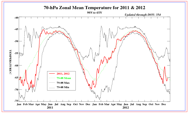
Here, we see observed stratospheric temperatures at the 70mb level, commonly known as one of the lowest levels in the stratosphere. Looking at the 2012 section, we see that recent stratospheric temperatures have taken an uptick to normal temperatures, expressed by the dashed green line. This uptick tells us that the stratosphere is now at average temperatures, and the polar vortex is now at average strength. That's a good starting point to tell us what the stratosphere is currently like.
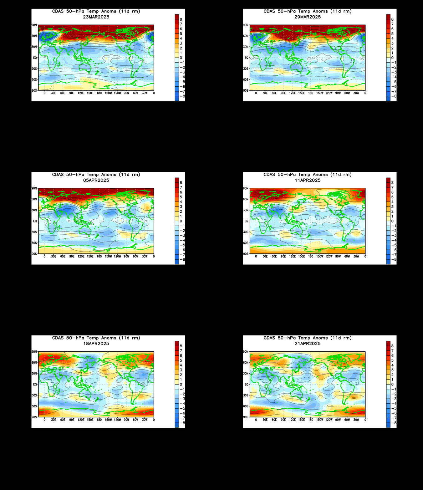
Let's continue our analysis of the observations of the stratosphere. This is an animation of observed temperatures at the 50mb level (slightly higher up in the air than the 70mb level) over the past month. In late November, we saw a large blob of red appear and propagate into the Arctic Circle. This was a significant stratospheric warming (SSW), meaning warm air from the lower atmosphere was pushed into the stratosphere. This was also shown in the 70mb chart by that spike in observed temperatures a month ago.
I want to dig deeper into the time just before that warm air shot into the Arctic Circle. Try and watch for the observation on November 25-27. If you can see it, you can see how the warm air entered east Asia before blowing up and shooting into the Arctic. Looking at the most recent December image, we can see that another small blob of warm air has emerged in central Asia. Judging by the last two or three images, this blob also looks to be entering East Asia, meaning we could see another stratospheric warming if this warm air shoots into the Arctic Circle.

This is the 8-10 day height anomalies at the 500mb level. The 500mb level is the best area to identify areas of low pressure (blues) and high pressure (reds). Stormy patterns and quiet patterns correspond to these colors, respectively. The image is of two model forecasts- the one on the left is the ECMWF model, and the one on the right is the GFS model. For those unfamiliar with the polar vortex, it is a permanent low pressure system stationed over the Arctic. When enhanced low pressure is over the Arctic, the polar vortex (PV) is stronger than normal, and high pressure weakens the polar vortex.
The model forecasts above both show big high pressure centers interrupting the polar vortex and splitting it into two pieces. Such a split exemplifies the traditional weakening of the polar vortex. When that polar vortex is weakened, the cold air locked up in said polar vortex flows south, possibly into North America, maybe into the US. This is a very good sign coming from the models at this point in time to go along with the stratospheric observations.

Continuing with watching the models, we turn to a charted forecast of the ECMWF model. I want you to look at the bottom image, called the EP Flux. In short, the EP flux shows the direction and strength (shown by length of arrow) that air moves into the stratosphere. In events where warm air enters the stratosphere, long, extended arrows are commonly seen. The forecast into the days before New Year's Day show a batch of extended arrow motions, suggesting a large motion of warming may be incoming into the stratosphere. This enhanced EP Flux would theoretically enhance warming potentials in the Arctic, thus further weakening the Polar Vortex. I find it likely that the aforementioned 50mb wave over East Asia would be to blame for this rise in EP Flux values.
Take a look at the two ECMWF Forecasts below:
These two images are for different levels of the stratosphere. The top level is the 100mb level, essentially the lowest part of the stratosphere. The bottom image is the 1mb level, the highest part of the atmosphere. Look closely and see if you can spot the 'L' letter in each image. This is the predicted center of the polar vortex at the Hour 240 for both images.
The top image of the 100mb level has the polar vortex centered in East Asia. Note the warming occurring in North America, another sign of cold potential at the surface (more on that later). Now take a glance at the 1mb image. The polar vortex is now shown to be to the east of Greenland. They are pretty far apart! Why does it matter? Take a look at the analogy below.
Think of the game Jenga. You must try to take out pieces of the tower to get as many pieces out, but still have it standing. The more pieces you take out on one side, the more unstable that side becomes, and eventually the tower falls down because of the difference in stability of the tower (a.k.a. where more blocks are placed). In a similar situation, when you have the polar vortex far apart in different levels, like what is forecasted above, the polar vortex becomes more unstable and weakens, possibly to the point of collapse.
One more analogy for you: Think of the polar vortex like a cylinder full of cold air. If you cut the cylinder in half and move one half away from the other, the cold air will sink. That is exactly how the stratosphere. If you have displaced parts of the stratosphere, the cold air that is held in the polar vortex will be released and flow down into lower latitudes. If the PV is displaced enough, it may collapse altogether, leading to an icebox solution over parts of the world.
The GFS model also shows the displacement of the polar vortex at Hour 240:
 |
| Pressure at hour 240 at the 1mb level |
 |
| Pressure at Hour 240 at 100mb level |
Here is what I have gathered:
-Current stratospheric temperatures are at average values.
-A strong warming event looks to occur at the end of December.
-Very elevated EP Flux forecasts enhance such a warming potential.
-The polar vortex will become displaced as a response.
-High pressure forms over the Arctic, further messing up the polar vortex.
-AAM QBO values are already turning positive, increasing the potential for the permanent warming event to switch winter to spring later on in 2013.
All of the factors above combined, severe damage looks to be done to the polar vortex. I can envision a partial collapse of the vortex occurring, which would only lead to enhanced cold outbreaks in the United States. I am not confident on this collapse occurring, but if there is a best time for such a collapse to happen, it could be coming up at the end of this year.
Keep a sharp eye out for prolonged cold weather if these forecasts by the ECMWF and GFS verify.
Andrew

.gif)