This is your 7 AM Wake-Up forecast for October 3.
 |
| Real-Feel Temperature |
Your 7 AM Real-Feel temperature will be pretty chilly tomorrow morning. Temperatures will start out in the 30's for some areas in the Midwest back through the Ohio Valley as clear skies take away the previous day's gathered heat. The Plains and more of the Midwest, even down into the South, will experience some 40's as they wake up. Some fruits could become damaged by these cooler temperatures, so farmers should take precautions. The West will wake up to a variety of temperatures, mainly within the 40-50 range, but the mountains will wake up to below 40 degrees.
 |
| Actual Temperatures |
Actual temperatures will be slightly higher than the real-feel temperatures, probably a few degrees higher than the real-feel temperatures. However, it is still advised you wear a jacket as real-feel temperatures can make you feel colder than you actually are and may affect your body differently.
 |
| Surface Winds |
Surface winds won't be horribly significant, with pockets of higher winds in the Dakotas and Southern Plains.
 |
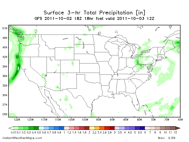
| 3-Hour Precipitation |
The Northeast will wake up to some rain not accumulating to anything big, but probably around .2-.4 inches accumulation. Portions of the Plains may get in on a couple sprinkles while the West Coast will get a batch of rain.
 |
| Wind Chill |
The wind chill below 40 degrees will be present in portions of the Midwest and Great Lakes, but the Ohio Valley and portions of the Southeast will get a larger area of below 40 degree wind chills. The Colorado Mountains will also keep wind chills below 40 degrees.