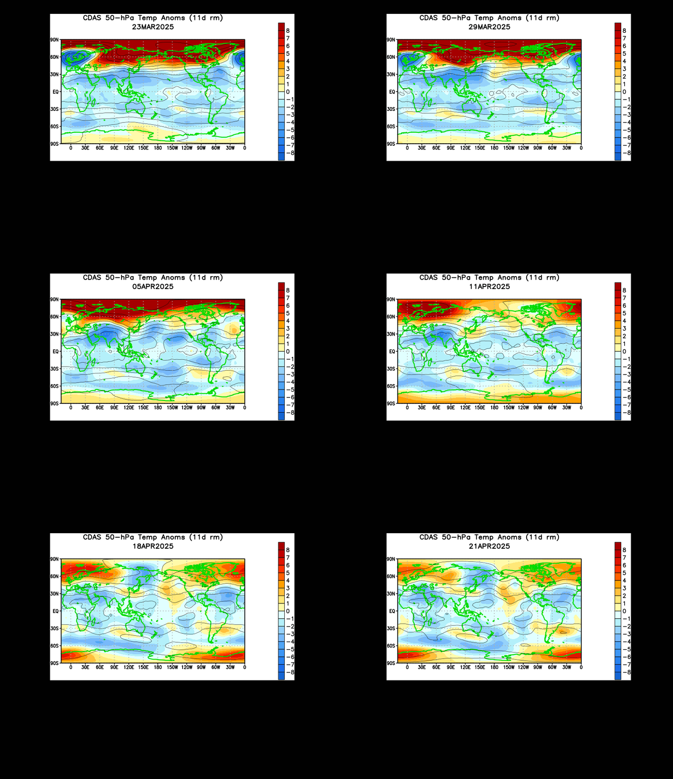
As expected, the sudden stratospheric warming has begun over Canada as of the day after Christmas. This sudden warming is signified by massive warm temperature anomalies flooding into the Arctic.
In these sudden stratospheric warmings (SSW), warm air penetrates the stratosphere and is forced up high into the stratosphere. When the warm air is forced up, cold air originally from the stratosphere is forced down to the surface. There is a couple week lag between sudden stratospheric warmings and cold air reaching the surface. I'm not confident of the exact number of days it takes for this cold to hit the surface, but I think we should see this SSW's effects by mid to late January, something that could bring downright frigid air to much of the nation IF the atmospheric pattern cooperates.
It should be mentioned that SSW's cause trough formation later on. Like we saw with the Dec. 1-6 SSW in the first several frames of the animation above, we are now seeing forecasts of low pressure building in the Bering Sea, right where that first SSW occurred. If the same rule applies, the end of January could see anomalous low pressure building over Canada, possibly extending into Greenland- something that could ignite the infamous, anti-cold-and-snow positive NAO. But that's a different post for a different time.
Andrew


4 comments:
please give us some examples of this cold wave something like 5 to 10 degress below normal????????????
"When the warm air is forced up, cold air originally from the stratosphere is forced down to the surface."
Sadly...no.
Nothing of the kind happens. Ever.
Sorry.
This analysis is complete BS.
You should do a post on comet ISON. If you haven't heard about it yet, look it up. If you can, also give a write up on comet panstarrs. I think these posts would please a lot of people. Also it gives you something to write about even though there isn't any weather. Thanks :)
Anonymous: I cannot do that.
TQ: What about air displacement? Warm air in, cold air out. Surely if you know how physics work, you would know that's what happens in an SSW.
Anonymous: Space weather has always intrigued me. I may do a post on that.
Post a Comment