
The winter's most sizable sudden stratospheric warming event to date has commenced.
 The animation above shows us temperature anomalies in the 10 millibar level of the atmosphere, which is located way up in the upper stratosphere. We see how the stratosphere has been rumbling since mid-January with attempts at a stratospheric warming event, but it is only as of the last few days that the stratosphere saw a massive warming event, titled a sudden stratospheric warming (SSW) event. To see how big this event is, let's head down to the 30 millibar level, located further down in the atmosphere compared to the 10mb level.
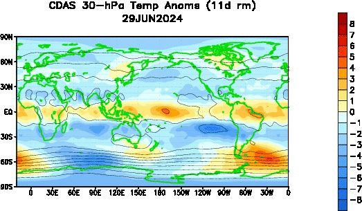 The 30mb temperature anomaly animation above shows how the stratospheric polar vortex has been under attack for a longer period of time compared to the upper stratosphere. We see a large swath of warmth had been developing and manifesting itself in Eurasia in January into February before finally bursting into the upper latitudes. It is now clear that the sudden stratospheric warming event has extended itself into a decent chunk of the stratosphere. Let's check up on the 50 millibar level next.
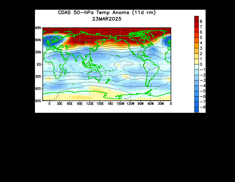 The 50mb level is also seeing significant warming in the upper latitudes, which only confirms the idea that this is indeed a sudden stratospheric warming event, quite possibly the first one we've seen this whole season.
Why is this a big deal? The sudden stratospheric warming phenomenon allows the polar vortex to weaken, and this enhances the possibility of Arctic cold outbreaks not unlike those we saw earlier in January. I'm not saying we will see January 2014-level cold again, the prospects of cold outbreaks rise roughly 2-4 weeks after the sudden stratospheric warming occurs. This would place cold weather prospects in the February 18-March 4th period. It's already looking like we'll see a cold blast to kick off March, and this could be related.
 The ECMWF model sees this intrusion on the stratosphere continuing, forecasting continued elevated geopotential-Wave 1 activity at the 10 day forecast period. We see the elevated values maximized around the 3mb to 30mb levels, with lesser influences downwelling as low as the 500mb level. It is likely that this will be the biggest stratospheric intrusion this season, as we are just about to wrap up the meteorological winter season, and the "final warming" (where polar winds reverse to signal the end of the SSW season) isn't too far away.
Andrew
Why is this a big deal? The sudden stratospheric warming phenomenon allows the polar vortex to weaken, and this enhances the possibility of Arctic cold outbreaks not unlike those we saw earlier in January. I'm not saying we will see January 2014-level cold again, the prospects of cold outbreaks rise roughly 2-4 weeks after the sudden stratospheric warming occurs. This would place cold weather prospects in the February 18-March 4th period. It's already looking like we'll see a cold blast to kick off March, and this could be related.
Andrew
6 comments:
good I hate warm air in the winter. bring on the snow!
Andrew
How about the LRC 57 day cycle?
It would seem that March should be cold if the LRC plays out after the cold January
I agree with you anonymous! Nothing worse than warm weather in winter! It causes the snow to melt too fast ..it causes the TV weatherpeople to say things like "oh boy ! spring is on the way!!" in a jolly voice...and it causes so much of the precipitation to be wasted in RAIN! Yuck! Thank you Andrew for all of your enlightening posts! I am a big fan!
Even though the northeast gets all the media press, it really has been the Central US that has suffered this year...well above average snow and well below normal temps. In KC...our average temp (high and low) for the first half of February was 16 degrees...17 degrees below normal. No place at that latitude (think Washington DC) comes even close.
But flyover country isn't important. For all the "snowmaggedon" for the NE, I noticed DC was back in the 50s already.
You realize, of course, the press coverage of the I-95 corridor is because over 100 illion people live in that stretch of real estate, right?
Great, the northeast gets screwed with another round of temperatures 20-25 degrees below normal. The winter from hell knows no end.
Post a Comment