A pending stratospheric warming event, which I initially discussed in a post a few days ago, looks to preclude an outbreak of colder than normal air in mid-December.
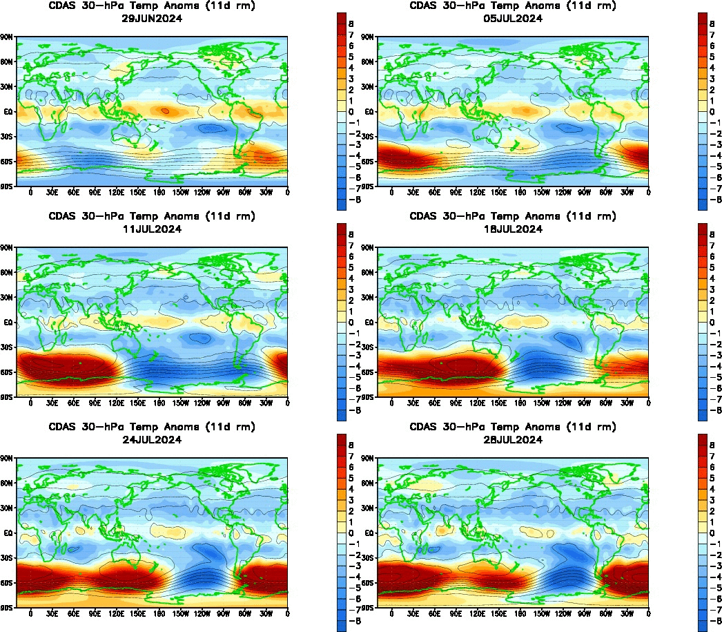
We begin with an animation of the 30-millibar temperature anomalies, from the Climate Prediction Center. As previously discussed, we've seen two areas of warmer than normal temperatures merge over Eurasia after forming in Western Europe and East Asia. Since the previous post, we have seen this body of warmer than normal temperatures intensify, but also begin sliding north and east at an accelerated pace, towards extreme northeast Russia and the Bering Sea.
Typically, stratospheric warming events originate from the Bering Sea region. This happens because, most often, bodies of warmer than normal air form over East Asia, and the easiest route northward into the Arctic Circle is through the Bering Sea. This time around, however, the stronger pool of warm air over Europe absorbed the East Asian pool of warm air, and they're now one big area of warm air over northern Eurasia.
I noted that this warm air is accelerating and moving northeast because this is typically a signal that it's "crunch time" for the warm air. In other words, it's making its move north into the Arctic Circle now, so it must either actually make it into the Arctic Circle, or be rejected and stay at lower latitudes, where it may then dissipate. From this animation, it looks like the warm air will take the former option, but let's look at the 50-millibar level for clarification.
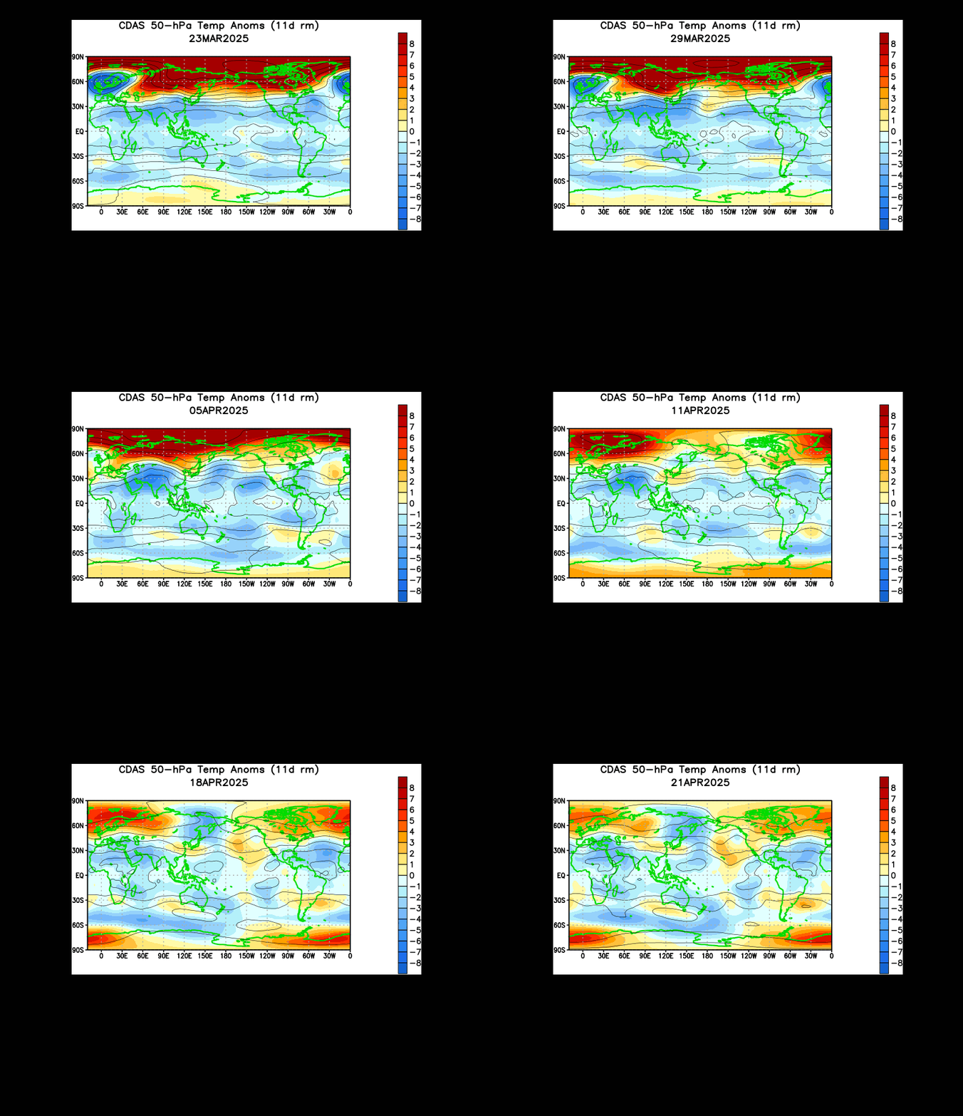
An animation of the 50-millibar temperature anomalies reveals a very similar picture to what we just saw at the 30-millibar level. A key difference, however, is the blossoming of the warmer air temperatures a little further north and east than at the 30-millibar level, and this pool of warmer air also looks like it's about to make its move to try and get into the Arctic Circle. We can already see some warmer temperature anomalies blossoming into the Arctic Circle at the very top of the animation, just northwest of Alaska, and this is a promising sign for the warmer temperatures in the sense that they should be able to push north and initiate a stratospheric warming event.
At the moment, the 50-millibar layer that we just looked at currently looks like this. Above is a temperature map (not anomalies, but actual temperatures) of the 50-millibar level as of last night. We can clearly see the warm pool located just west of the Aleutian Islands, as well as its main opponent, the polar vortex, located over Greenland. Let's step forward in time and see what the GFS predicts will play out in ten days.
By the 10-day mark, we see a battle ongoing between that pool of warmer air (which by this time appears to have intensified further), and the polar vortex at this part of the stratosphere (which looks to have weakened a bit and become displaced into northern Asia). Of course, this is a ten day forecast so it's quite possible the actual result does not resemble this image, but with forecast models generally agreeing on something like this evolving, I expect to see this forecast verify more or less as pictured, with the pool of warm air still encroaching on the polar vortex at the 50-millibar level.
So, we've established that a stratospheric warming event (but not an SSW) is expected to occur in coming days. What will we experience here on the surface?
Both the GFS (left) and ECMWF (right) predict a wavenumber-3 pattern evolving at the 500-millibar level in the 8-10 day window, with those three ridges pushing way up into the Arctic Circle, centered in the Pacific Northwest, Greenland, and Eurasia. You'll notice some discrepancies, such as the ridge actually becoming cut off in the GFS panel and the Greenland ridge not nearly as stout as shown in the ECMWF panel, but the main idea of this wavenumber-3 pattern evolving in the medium-term is in pretty strong agreement between these two models.
You may also notice just how favorable of a pattern this is for cold weather in the Central and especially Eastern U.S. The positive Pacific North American (PNA) index pattern, evidenced by the strong ridge along the west coast of North America, sends the jet stream well north into Canada, and then crashing back south into the Plains, and typically further south than normal, such as near the Gulf Coast. This pattern alone is favored to bring chilly air to the aforementioned regions, but it's the negative North Atlantic Oscillation (NAO) pattern that "seals the deal" here.
The negative NAO is shown by the ridge over Greenland, which similarly forces the jet stream well to the north, like we saw with the positive PNA pattern. This time, however, it is pushed so strongly north that on either side of the ridge, depressions in the jet stream form. If you enjoy the technical side of weather, you'll see this is a Rossby Wave orientation. That depression in the jet stream to the west of Greenland allows the jet stream to buckle south even further into the Southeast U.S., before pushing up north along the East Coast. That's why you may hear Eastern U.S. winter weather fans get excited about a negative NAO pattern, because it bends the jet stream so the storm track goes right up along the East Coast for those (in)famous Nor'easters.
But what about the longer-range? I'm glad you asked!
The CFS climate model "weeklies" paint a similar picture to the GFS and ECMWF- where as the two models above forecast the atmosphere out until ~12/8 in that picture, the CFS model above provides forecasts for the 12/12 - 12/18 period and the 12/19 - 12/25 period. As you might expect, the first period is a continuation of the pattern displayed in the GFS & ECMWF, with very cold conditions in eastern North America surrounded by warmer than normal air temperatures in the Western U.S. and in Greenland, thanks to the +PNA and -NAO features described above.
The forecast for Week 4 takes the foot off the gas to some extent, returning the depth of the cold air north into Canada but still leaving the Mid-Atlantic and overall Northeast with some cooler weather.
To Summarize:
- A stratospheric warming event is likely to occur in the coming days, most notably at the 30-millibar level and below (i.e. 50-millibar, 70-millibar....).
- This is unlikely to be an SSW event.
- Colder than normal weather is likely in the Central and East U.S., as well as eastern Canada, for the second and third weeks of December.
- A moderation in the weather is then expected for the Eastern U.S. by Christmas, while cold weather persists in eastern Canada.
- I'm not yet confident enough to predict any possible snowstorms in this pattern, and will wait until the pattern actually presents itself before trying to make such predictions.
Andrew
 |
| CPC |
Typically, stratospheric warming events originate from the Bering Sea region. This happens because, most often, bodies of warmer than normal air form over East Asia, and the easiest route northward into the Arctic Circle is through the Bering Sea. This time around, however, the stronger pool of warm air over Europe absorbed the East Asian pool of warm air, and they're now one big area of warm air over northern Eurasia.
I noted that this warm air is accelerating and moving northeast because this is typically a signal that it's "crunch time" for the warm air. In other words, it's making its move north into the Arctic Circle now, so it must either actually make it into the Arctic Circle, or be rejected and stay at lower latitudes, where it may then dissipate. From this animation, it looks like the warm air will take the former option, but let's look at the 50-millibar level for clarification.
 |
| CPC |
 |
| CPC |
 |
| CPC |
So, we've established that a stratospheric warming event (but not an SSW) is expected to occur in coming days. What will we experience here on the surface?
 |
| Penn State |
You may also notice just how favorable of a pattern this is for cold weather in the Central and especially Eastern U.S. The positive Pacific North American (PNA) index pattern, evidenced by the strong ridge along the west coast of North America, sends the jet stream well north into Canada, and then crashing back south into the Plains, and typically further south than normal, such as near the Gulf Coast. This pattern alone is favored to bring chilly air to the aforementioned regions, but it's the negative North Atlantic Oscillation (NAO) pattern that "seals the deal" here.
The negative NAO is shown by the ridge over Greenland, which similarly forces the jet stream well to the north, like we saw with the positive PNA pattern. This time, however, it is pushed so strongly north that on either side of the ridge, depressions in the jet stream form. If you enjoy the technical side of weather, you'll see this is a Rossby Wave orientation. That depression in the jet stream to the west of Greenland allows the jet stream to buckle south even further into the Southeast U.S., before pushing up north along the East Coast. That's why you may hear Eastern U.S. winter weather fans get excited about a negative NAO pattern, because it bends the jet stream so the storm track goes right up along the East Coast for those (in)famous Nor'easters.
But what about the longer-range? I'm glad you asked!
 |
| CPC |
The forecast for Week 4 takes the foot off the gas to some extent, returning the depth of the cold air north into Canada but still leaving the Mid-Atlantic and overall Northeast with some cooler weather.
To Summarize:
- A stratospheric warming event is likely to occur in the coming days, most notably at the 30-millibar level and below (i.e. 50-millibar, 70-millibar....).
- This is unlikely to be an SSW event.
- Colder than normal weather is likely in the Central and East U.S., as well as eastern Canada, for the second and third weeks of December.
- A moderation in the weather is then expected for the Eastern U.S. by Christmas, while cold weather persists in eastern Canada.
- I'm not yet confident enough to predict any possible snowstorms in this pattern, and will wait until the pattern actually presents itself before trying to make such predictions.
Andrew

No comments:
Post a Comment