It looks like a stratospheric warming event is preparing to occur in the far upper latitudes across multiple layers of the atmosphere. However, as we'll see, this does not look to be either a Sudden Stratospheric Warming (SSW) event, nor an event strong enough to seriously destabilize the stratospheric polar vortex.
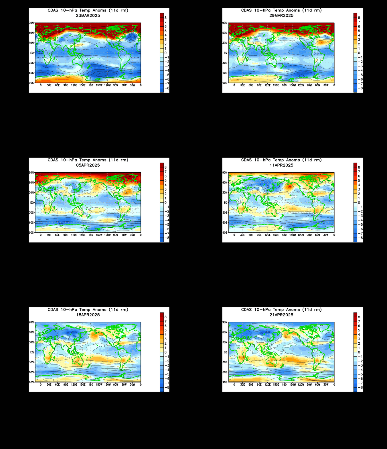
Following a failed attempt at a (very early) stratospheric warming event, which would have originated in the Bering Sea / North America region in late October, colder than normal air temperatures overspread the region, indicative of a strengthening of the polar vortex at that altitude. However, around November 12th, two areas of warming began blossoming at this level of the atmosphere- in western Europe, and in East Asia.
The warming in East Asia is important, as stratospheric warming events that form in the region have an easy path to bloom northward through the Bering Sea and initiate a stratospheric warming event. This time around, the warming in Japan seems to have shifted west, as warmer than normal temperatures in Europe have dominated.
For now, the mass of warmer air continues to bide its time over Europe, and may make a move towards the Arctic Circle within the next couple of weeks. However, we'll need to take a look at other layers of the stratosphere too, since the 10-millibar layer (and at higher altitudes) is notorious for being volatile in the nature of such warmings.
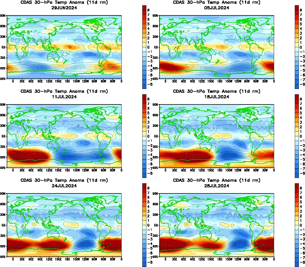
We now head down the latter a couple rungs to see temperature anomalies at the 30-millibar level. Following the late-October failed attempt at a warming event (which, you'll notice, was quite weaker at this level than at the 10-millibar level), colder than normal temperatures engulfed North America at this section of the stratosphere. Similar to how you need to check multiple layers of the stratosphere to see the depth (or lack thereof) of a possible warming event, the display of such cold temperatures at both the 10-millibar and 30-millibar layers is a testament to how strong the colder than normal temperatures actually were, and a testament to why that late-October warming didn't pan out.
On an interesting note, observe how that mass of warmer than normal temperature anomalies over Europe is actually warmer (in anomaly terms) than that at the 10-millibar level. This is rather uncommon, as you'll typically see the strongest anomalies higher up in the atmosphere, not lower in the atmosphere. I interpret that as a sign that this warming event may be "for real", but of course only time will tell for sure.
Also interesting is how that mass of warmer than normal temperatures over Europe at the 30-millibar mark is starting to shift the highest-magnitude anomalies slowly north and east, ever closer to the upper latitudes and Arctic Circle. When this process of northward movement starts, it generally either culminates in blooming into the Arctic Circle with a stratospheric warming event, or it's rejected and must stay at those lower latitudes, where often it then dissipates.
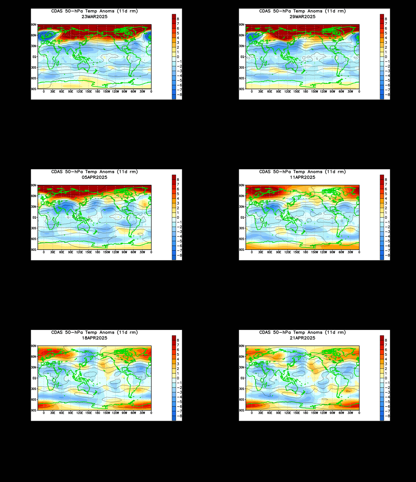
A little further down the road we come to the 50-millibar level of the stratosphere. The warm pool we've seen in the previous two animations is now one of a two-pronged approach, as the massive area of warmer than normal temperatures originated from two separate sources in East Asia and West Europe, now combined across Eurasia.
The strongest positive anomalies have recently combined in far north Eurasia, and seem to be trying to edge north. Again, this could be a precursor to a stratospheric warming event if that body of warm air were to advance into the Arctic Circle, and while I personally think that is certainly a possible outcome, I'm not completely sold just yet. Let's take a look at wind speeds to ascertain just how likely a stratospheric warming event may be.
The above chart is a forecast from the ECMWF model, and may at first appear complicated, but in reality is rather simple. Let's dissect it piece by piece.
The top panel shows observed wind speeds at the 1-millibar level in blue, and forecasted values in black. Sudden Stratospheric Warming (SSW) events will tend to reverse the wind direction, if not at least slow it down to near zero as that warmer air pushes north into the Arctic Circle and ridging tries to take hold. We see only a modest slowdown over the forecast period, signaling that a stratospheric warming event of any kind may not be influential to the weather pattern here in the troposphere.
The second panel shows the same parameter as the top panel, but this time for the 10-millibar and 30-millibar levels, which we analyzed earlier. We see a more pronounced slowdown in wind speeds at these levels over the forecast period, though not sufficiently near zero. Despite this, I do see this slowdown in wind speeds as a sign that this stratospheric warming event may occur, though again perhaps not to an influential degree.
The third panel shows two forms of fluxes, and while we won't discuss them in-depth, the increasing values over the forecast period once again show at least some degree of warming activity in the stratosphere. The final two panels are not as pertinent to the discussion.
To Summarize:
- Based on observations from multiple layers of the stratosphere, as well as forecasts from the ECMWF, a stratospheric warming event does appear likely to take place in the near future.
- An SSW event is not expected.
- While it remains to be seen if this will have a notable impact on the weather pattern here in the troposphere, it should at least provide further opportunities for cooler than normal weather conditions around the mid-late December period.
Andrew
 |
| CPC Animation of temperature anomalies at the 10-millibar level. |
The warming in East Asia is important, as stratospheric warming events that form in the region have an easy path to bloom northward through the Bering Sea and initiate a stratospheric warming event. This time around, the warming in Japan seems to have shifted west, as warmer than normal temperatures in Europe have dominated.
For now, the mass of warmer air continues to bide its time over Europe, and may make a move towards the Arctic Circle within the next couple of weeks. However, we'll need to take a look at other layers of the stratosphere too, since the 10-millibar layer (and at higher altitudes) is notorious for being volatile in the nature of such warmings.
 |
| CPC Animation of temperature anomalies at the 30-millibar level. |
On an interesting note, observe how that mass of warmer than normal temperature anomalies over Europe is actually warmer (in anomaly terms) than that at the 10-millibar level. This is rather uncommon, as you'll typically see the strongest anomalies higher up in the atmosphere, not lower in the atmosphere. I interpret that as a sign that this warming event may be "for real", but of course only time will tell for sure.
Also interesting is how that mass of warmer than normal temperatures over Europe at the 30-millibar mark is starting to shift the highest-magnitude anomalies slowly north and east, ever closer to the upper latitudes and Arctic Circle. When this process of northward movement starts, it generally either culminates in blooming into the Arctic Circle with a stratospheric warming event, or it's rejected and must stay at those lower latitudes, where often it then dissipates.
 |
| CPC Animation of temperature anomalies at the 50-millibar level. |
The strongest positive anomalies have recently combined in far north Eurasia, and seem to be trying to edge north. Again, this could be a precursor to a stratospheric warming event if that body of warm air were to advance into the Arctic Circle, and while I personally think that is certainly a possible outcome, I'm not completely sold just yet. Let's take a look at wind speeds to ascertain just how likely a stratospheric warming event may be.
 |
| FU-Berlin |
The top panel shows observed wind speeds at the 1-millibar level in blue, and forecasted values in black. Sudden Stratospheric Warming (SSW) events will tend to reverse the wind direction, if not at least slow it down to near zero as that warmer air pushes north into the Arctic Circle and ridging tries to take hold. We see only a modest slowdown over the forecast period, signaling that a stratospheric warming event of any kind may not be influential to the weather pattern here in the troposphere.
The second panel shows the same parameter as the top panel, but this time for the 10-millibar and 30-millibar levels, which we analyzed earlier. We see a more pronounced slowdown in wind speeds at these levels over the forecast period, though not sufficiently near zero. Despite this, I do see this slowdown in wind speeds as a sign that this stratospheric warming event may occur, though again perhaps not to an influential degree.
The third panel shows two forms of fluxes, and while we won't discuss them in-depth, the increasing values over the forecast period once again show at least some degree of warming activity in the stratosphere. The final two panels are not as pertinent to the discussion.
To Summarize:
- Based on observations from multiple layers of the stratosphere, as well as forecasts from the ECMWF, a stratospheric warming event does appear likely to take place in the near future.
- An SSW event is not expected.
- While it remains to be seen if this will have a notable impact on the weather pattern here in the troposphere, it should at least provide further opportunities for cooler than normal weather conditions around the mid-late December period.
Andrew

No comments:
Post a Comment