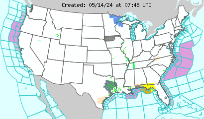
The pink are winter storm warnings, which we can see extending from the Upper Plains, covering basically the entire Rocky Mountains. The storm is a very intense storm.

Above is the infrared imagery on the storm. The storm stretches from Mexico well into Canada.
Typically, people in the Midwest would be worried about this storm. But the jet stream will take a sharp dive and set up a pattern bringing the storm up into the Plains instead.
The major snowstorm would set up in the Northwest into the Upper Rockies with light snow extending into much of the Rockies through the Northwest and Canada.

Above is the current GFS forecast track for the New Years storm. The heaviest snow would occur to the west of this system, with heavy rain to the east.

No comments:
Post a Comment