There is a 40% chance for tropical cyclone in the next 48 hours.
A system located off the west coast of Central America and to the south of Mexico has become better defined overnight. Conditions are favorable for gradual development, possibly into a tropical depression over the next several days.
The track for this system is in a somewhat general consensus that it will probably go out to sea. A couple of models do take this system into Mexico, which actually could be devastating as you'll see in the intensity forecasts. A band of models (the red line, turquoise, pink lines) seem to hold the best solution. That solution takes the storm out to sea. However, it will undoubtedly change as we progress.
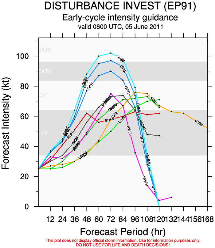
Right off the bat, one would see a very good consensus in the way of strength forecasts of this storm. However, if you look closer, those 3 models with different shades of blue are actually the same model. They all originate from the same model and are ensembles inside an ensemble. Thus, it is logical to take out two of those blue lines to not confuse anyone. Other than the blue lines, there is a consensus taking the storm into a Category 1 hurricane status.
We will watch this system very closely and issue updates as needed.


No comments:
Post a Comment