
 |
| http://origin.cpc.ncep.noaa.gov/products/people/wwang/cfsv2fcst/imagesInd3/glbz200SeaInd4.gif |
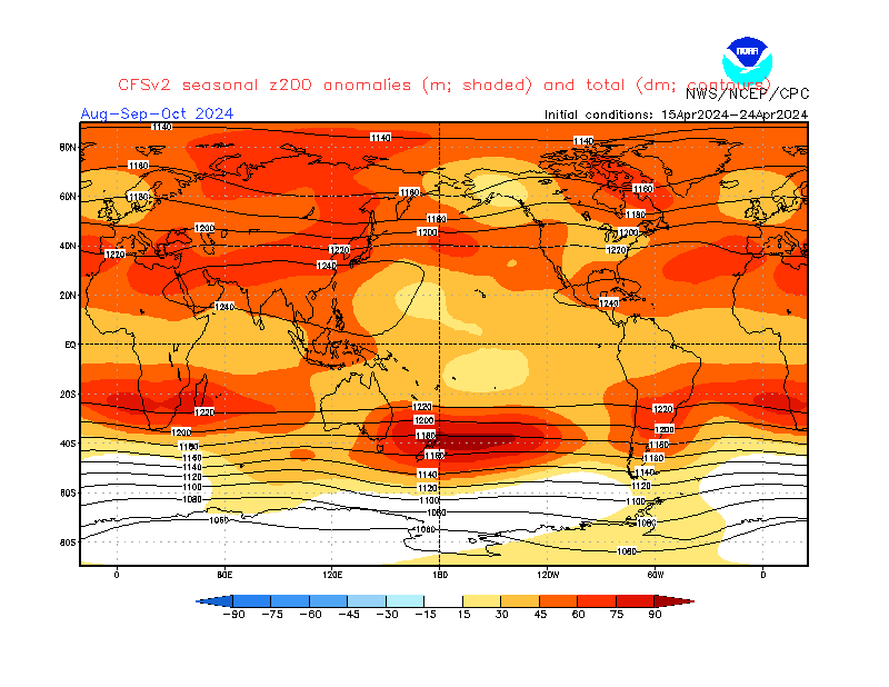
So, what does this all mean?
The ridge in the west and increased jet stream action in the southeast are characteristic of a positive PNA, which is made up of a high pressure system in the western part of the nation, as well as a storm track becoming enhanced over the Plains and Midwest into the East Coast. The graphic of a positive PNA can be seen below.
 |
| http://www.nc-climate.ncsu.edu/edu/k12/PNA/body |
Of additional interest is that this potential positive PNA may team up with the incoming El Nino. The El Nino is shown on the first image as an enhanced area of 200mb anomalies over the Southeast. This enhancement is characteristic of the sub-tropical jet stream, which is enhanced in an El Nino and gives the Northeast strong Nor'easters.
All of that said, if this were to turn out, we could have a 'saved' winter for the Midwest and Ohio Valley thanks to the positive PNA. However, I cannot confirm that this is in fact a positive PNA. This is just what it appears as, and could very well change in the future.
That's enough winter posts for today.
Andrew
3 comments:
Andrew, the CFS is showing signs of a +PNA. It could change but looks promising. I'll take it. With Nino -NAO, -AO, +PNA we'll all do well. Weak NINO.
Hey, Andrew, where do you get your historical analogue charts from? I'm going to be making a winter forecast in September, and I need to know where I can get those charts from.
ERN WX: Things certainly are looking up this winter.
Joshua: What charts are you referring to? The ones on the updated preliminary forecast?
Post a Comment