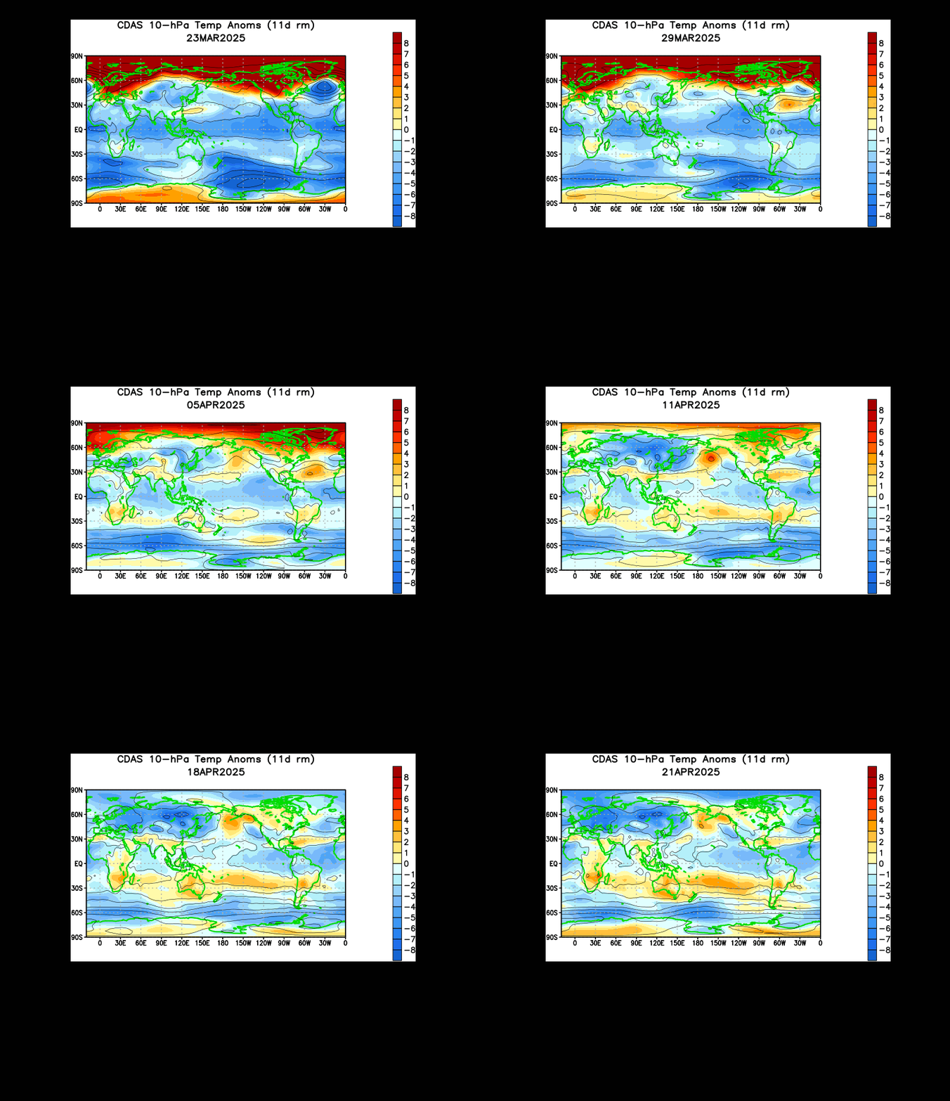
It now appears that the 10 millibar layer of the stratosphere has experienced a collapse of the polar vortex.
The above image shows a 6 day observation period of the stratosphere, with the first three days shown on the top half of the image and the most recent three days observed on the bottom half of the multi-panel image. You can see that recently, instead of two areas of yellows and greens, there is now one. These circles of brighter colors show the polar vortex, split into multiple vortices as a result of a phenomenon known as the sudden stratospheric warming.
In a sudden stratospheric warming, warm air is suddenly forced up through the stratosphere at varying degrees. The animation of the 10 millibar layer above (same atmospheric layer as the top image) confirms that we have seen (and continue to observe) a historic sudden stratospheric warming that has broken daily maximum stratospheric records. All that red on the image is unusually warm air. See how it can't be contained in the Arctic and has actually now gone into the East US? That's how strong this warming is.
Now, this collapse has some positive consequences for February, as far as winter prospects go. The collapse of this layer means other layers of the stratosphere are now also more prone to collapse, something we may see in the 20 millibar and 5 millibar layers. However, that's about as bad as it'll get- in the stratosphere. Down here in the troposphere, where we live, cold air is now provoked to move south and may have to spread to lower latitudes. It's a give and take scenario- warm air goes in the stratosphere, thus cold air is displaced down into the troposphere. If we can continue to see weakening (or even collapse) of the polar vortex at other levels, cold air becomes increasingly likely for the end of January into February, and I already have some indicators rooting for a very cold February.
Andrew


7 comments:
What's up w/the blowtorch the next two weeks. How long does it take for CPF and the PV collapse to actually effect America. Another warm period in the offing.
Andrew I think you ment to say down here in the thermosphere whare we are, u said troposphere.
Indndawg: The cold begins January 22nd or so.
Art: We are in the troposphere. Please don't spread false information.
Well, I have seen no good news for Colorado...
Drought conditions have taken a turn for the worse as snow chances have yet to come for anyone east of Continental Divide, and they will never come again as the storm track shifts north and east, temperatures soar and even the mountain snowpack is only 40% of normal despite the recent storms, since the moisture content of the snow is almost non-existent, this looks permanent, since the drought is self-sustaining...no storm chances for us this month or next month as a powerful ridge develops over the entire west, the CPC is calling for a rainless, snowless spring for the entire southwest, and an unusually dry summer as The deadly La Nina looks like it will redevelop...this will be worse than the Dust Bowl if that happens, what did we do to deserve such terrible things...and will it ever end?
Andrew - great post as always.
Although it's snowing and cold here in the UK, it seems incongruous that such an 'historic' SSW should (so far) have such unhistoric effects on the ground.
Feb surely must have some interesting surprises in store!
GFS holds little hope here in Dixie for any sustained cold weather. Cold shot...westerlies take over and shunt most of cold out.
Post a Comment