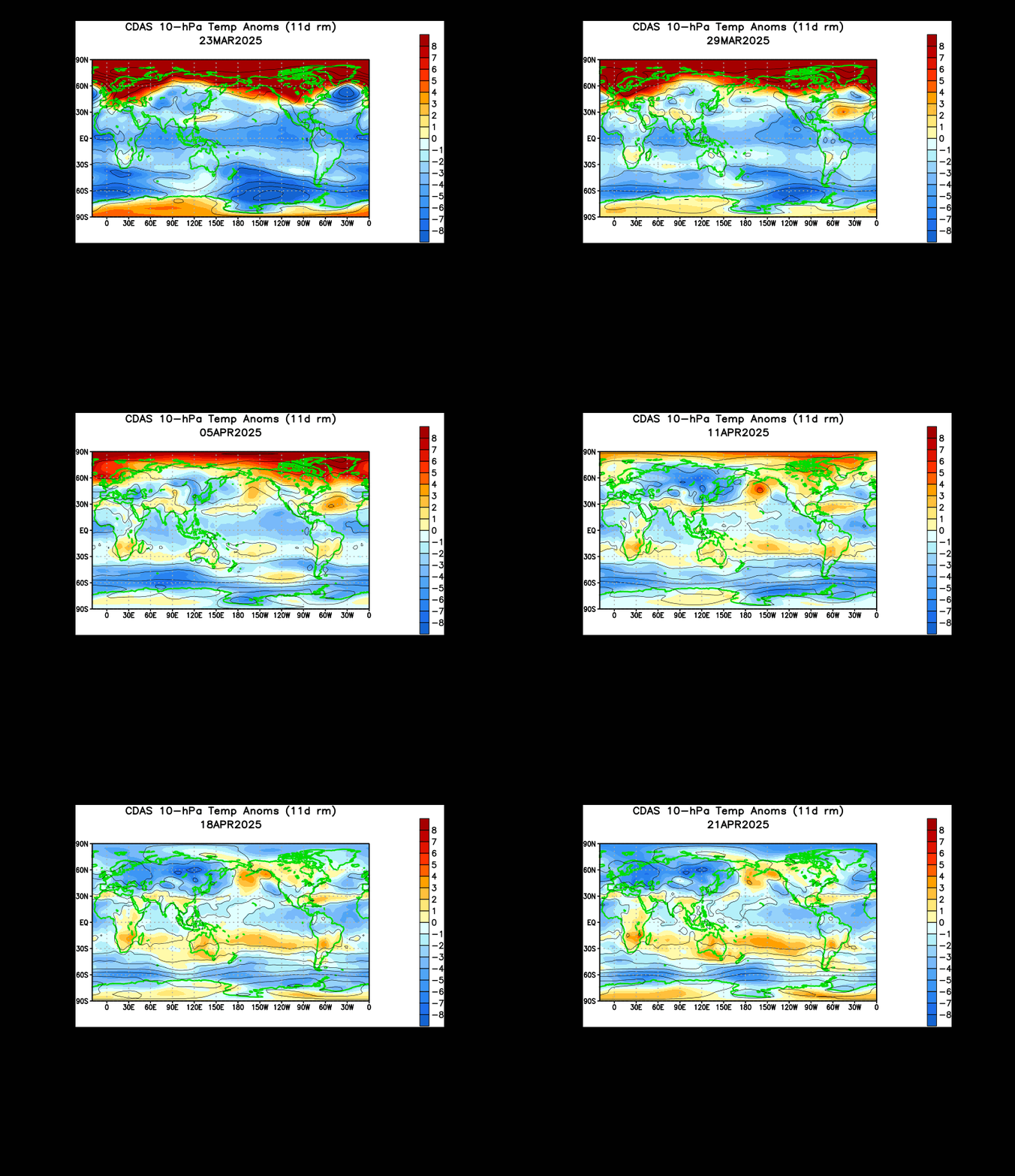
Shown above is an animation of 10 millibar temperature anomalies in the stratosphere. As I alluded to in my February 24th post, the Himalayan mountain range is a natural geographic instigator for these sudden stratospheric warmings. The enormous warming event we saw in January originated from the same mountain range we are now seeing this impending mass of warmth. Analyzing the above animation shows us that this warming event has been in the works since the beginning of February. In recent weeks towards mid and late February, we saw strengthening of this warming, and it became clear to me that this was not just a quick warming event. In my opinion, if you see a warming event over the Himalaya Mountains and it is sustained and strengthening, there's a solid chance that a sudden stratospheric warming could emerge from that situation.
The progression of this large swath of warming north and east towards the Bering Sea tells me that a sudden stratospheric warming is now unstoppable. We are seeing this large mass of warmth really push into the upper latitudes, and when it detaches from the Himalayan mountains like it most recently has, this means that the mass of warming must go elsewhere. I believe that we will see this mass of warming push into the Bering Sea and blow open into the Arctic. From there, we will most likely see low pressure development in the Bering Sea towards the beginning of April. In response, high pressure should form in the Gulf of Alaska and provoke a pattern that supports a stormy West and more or less zonal flow in the East that will not be conducive for any big Nor'easters or any general big winter storms. If there is to be solid winter weather during the spring months, expect it to be in the Northern Plains as a result of this pattern.
Andrew


3 comments:
I find that it is no coincidence that stratospheric warming events have been on the rise since the sudden "sleeping" of the sun, with one of the greatest solar minimums in over a century, with comparisons to the Dalton Minimum. Of course, you can also apply this to the current situation, look at how the 30 day sunspot cycles have been unusually low since late January, not only unusual considering we are supposed to be at the peak of a solar cycle, (major climate implications and variances in the sun's magnetic field I've discovered to be a missing link between that and the increase in volcano eruptions during solar minimums (Dalton Minimum's Mt. Tambora eruption which led to the "Year Without A Summer" in 1816.http://www.solen.info/solar/
Will this setup lead to severe weather across the U.S coming in the next few weeks?
Rob
Louisville,KY-
Hey Andrew, Does this mean that winter is over now for ohio and northern states? Or do you think there is one more storm yet to come this year? Thanks JT
Post a Comment