Wednesday, April 18, 2012

Late Season Snow for Northeast Possible Next Week

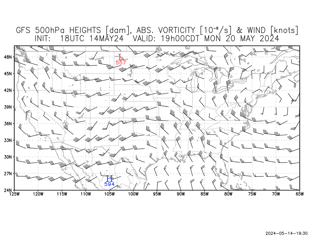
http://clients.customweather.com/plot_images/client_sites/WEATHERBELL
/GFS/final_WB013/WB013_500_GPM_VOR_WIND_HOUR_K_50.png
The latest GFS and ECMWF are hinting at a late season snowfall for the Northeast next week, as temperatures look to plunge below freezing and a massive storm system strengthens in the presence of the Atlantic Ocean. In this discussion, we will review things pointing towards the snowfall as well as caveats to the potential snowfall.

A caveat of this potential snowfall includes a crashing PNA index. The Pacific North American pattern, commonly referred to as the PNA, looks to be moving towards a negative phase around the time of the storm system. When the PNA is in a negative phase, a ridge is pressed into the Southeast and diverts storms away from the Northeast. Snowfall producing storms are favored in positive PNA situations. If this PNA forecast were to verify (which I am not completely sold on yet), the system would likely be forced away.

Something I would watch for is the NAO to help this storm. Seeing as it is being forecast into a negative phase, the North Atlantic Oscillation (NAO) would position variables to become conductive for a snowfall in the Northeast. I advise you not to totally take the NAO and run, because if you see the correlation with observations in the 14 day forecast on the bottom, there is only a 12% verification score in the past 4 months or so. Notice the glitch just before January 1. This likely battered down the score, so I would place the verification around 30%- still not very good.

Other Positives
•ECMWF/GFS model agreement is reassuring.
•NAO appears favorable for some light snow.

Other Caveats
•PNA must be considered.
•System remains 6-7 days out.

Tuesday, April 17, 2012

Strong Storm System May Ignite Active Weather Next Week

The image shown above is the 500mb height forecasts for 'Day 7', roughly a week out. At the 500mb level, one can detect low pressure systems when the lines are depressed into an upside-down arch. Ridges of high pressure are indicated in right side up arch formations.
In this forecast, made by the NCEP Superensemble, we see a very strong storm system swinging south which will likely shift into the Southeast. The ridge in place over the Central US will be shifted east or north with the invasion of this storm system.
I am worried about this right off the bat, considering that this strong a storm system will most likely latch onto the jet stream and stress it to increase wind speeds. Humid and warm air will boost instability in a scenario seen all too much this spring.
We have yet to see if this will verify, but the ensembles are very interested.

Andrew

Relatively Quiet Week in Store

The next 8-10 days are looking to be relatively quiet in terms of severe weather for the nation, as a strong vortex in the Gulf of Alaska looks to weaken and may also weaken storms that pass through the Southwest. That's where the 'quiet' part ends and the 'relatively' begins.
As you can see, there is a deep depression off the coast of California. This signifies the presence of low pressure systems in the area. Storms that form in that region typically shift east into the Southwest, where those storms have traditionally been known to then move east into the South Plains and fire up potentially strong storms. Notice the arch in the Southern Plains. This indicates the presence of a ridge of high pressure, which carries warm, humid air from the Gulf of Mexico within the region. Should storm systems move into the Southern Plains, the ridge would move east or north, and essentially form a frontal boundary which would bring north warm and humid air into the Southern Plains. A dry line would already be in place over west Texas. Saying that the storm system progresses east, and the cold front follows, severe weather may very well initiate.
But- let's not get ahead of ourselves. Gazing over the anomaly correlation (a verification tool) gives North America a verification score of roughly 75% over the past 2 months, give or take a week. Now- 75% may seem low. But, remember that the atmosphere is potentially the most complex mechanism known to man, maybe second to the universe itself. Having to keep track, and then forecast, an entire continent is an extremely hard task. Now, 75% seems pretty impressive. Of course, models can do better, but 75% is a fair score.

Side notes
•Expect a May outlook being formed over the weekend and likely up for release the following weekend.
•The 'Place to Be' is once again up and running. It gives the best weather place to be in the nation for the day.
•My apologies for the absence of forecast discussions. I am working to get them up and going again.

Andrew

April 17, 2012: Place to Be: Laredo, Texas

Today's Place to Be is Laredo, Texas.

High: 87
Weather: Mostly Sunny
Wind: NE at 11 MPH.


Monday, April 16, 2012

Notice

Hey everyone, I'm sorry that I haven't been able to put anything out today as I'm still pretty tired from being up late Saturday.
Today was not wasted, however-
I am planning a May outlook and added 4 new weather models. More to come.