Sunday, March 3, 2013

March 4-8 Significant Winter Storm (Updated 3/3)


A significant snowstorm is looking likely over many areas of the Plains and Midwest in the next three days to start off the workweek. It appears that the far northern Plains will bear the brunt of this event, where snowfall could exceed one foot. I can envision a wide swath of 6 to 12 inches from the Canada/US border down into the Great Lakes, with lower amounts to the west and east of this swath.

I did outline a swath in Wisconsin, Illinois and Iowa where I believe isolated spots of up to one foot of snow could fall. This results from fairly consistent forecasts of amounts flirting with one foot, as well as possible lake enhancement snowfall close to Chicago and Milwaukee. Latest model forecasts that I am observing as I type this show that this forecast may even need to be raised for many in the Plains and Midwest as a result.

In addition to the Midwest and Plains event, there will be an extreme snowfall event in the Mid-Atlantic, where the above forecast, fresh off the presses, shows 30 inches of snow hitting northern Virginia into eastern West Virginia in an event that would surely cripple transportation across much of the region. Amounts over a foot would be observed across much of the Mid-Atlantic, and snow days would be almost guaranteed if this forecast comes to fruition.

This model has been known to overdo snowfall forecasts, so the 30 inches could be too high. I anticipate amounts closer to the 2 foot mark going solely off this forecast. I will have to evaluate future forecasts to determine an amount that would suit this event, which could be quite an event judging by recent model forecasts.

You can find frequent updates on these two events on our Facebook page at www.facebook.com/TheWeatherCentre .

Andrew

Saturday, March 2, 2013

March 4-6 Potential Significant Winter Storm

Have upgraded storm title in accordance with latest model trends.
Satellite imagery indicates the storm system in question is currently still mainly offshore of the west coast of North America. The enhanced infrared values over land, however, show that this system is at least partially sampled into the upper air network. This means that weather balloons can collect data from the storm that then enhances model forecast verification chances. This is a point that I will restate in the next several minutes that you read this.


Recent observations of the latest model forecasts show that this system will be putting down some significant snowfall. The two images above show the 84 hour accumulated snowfall forecast for the GFS on top and NAM on bottom. As you can see, both models remain slightly different in placement of snowfall, and there are differences in snowfall amounts. The NAM model has more snowfall than the GFS, which is typical, since it has a wetter-than-normal bias. The GFS model and NAM model both indicate that there will be a heavy snowfall event in North Dakota, possibly into Minnesota. From there, we diverge into two different tracks. One track has heavy snow in Chicago and Milwaukee (essentially the NAM and European models), while the other track has the heaviest snow in Iowa and central Illinois (American model).

Looking at animations of recent model runs, I have seen a clear northward trend in model forecasts, more towards the first track I mentioned in the above paragraph. Because the system is just now getting onshore and into the weather balloon network, changes in the models were bound to occur. However, this last-minute shift north is interesting in more than how the system is now just getting onshore. I could see how the system maintains this north track. It will be coming into the US from the Pacific Jet Stream, which is the jet stream in the North US. As a result, it is more likely than not to be bound to the northern jet stream (essentially the northern track) than completely separating and shifting south, in my opinion. I feel like the recent models are also counting this factor in, but the big question is where the snow will fall. In that aspect, I can't say I'm too sure just yet. I will need to see another 12-24 hours of snowfall forecasts before I'm confident enough to issue an accumulation map. However, I am confident enough to say that I can make a preliminary map, which is shown above.

I may need to extend that 'Heaviest Snow' area further south and east with time, but I'm just not confident enough yet to bring it in that direction.

Andrew

Friday, March 1, 2013

Sudden Stratospheric Warming Imminent

I am seeing increasing signs that a sudden stratospheric warming is about to take place in the upper stratosphere.

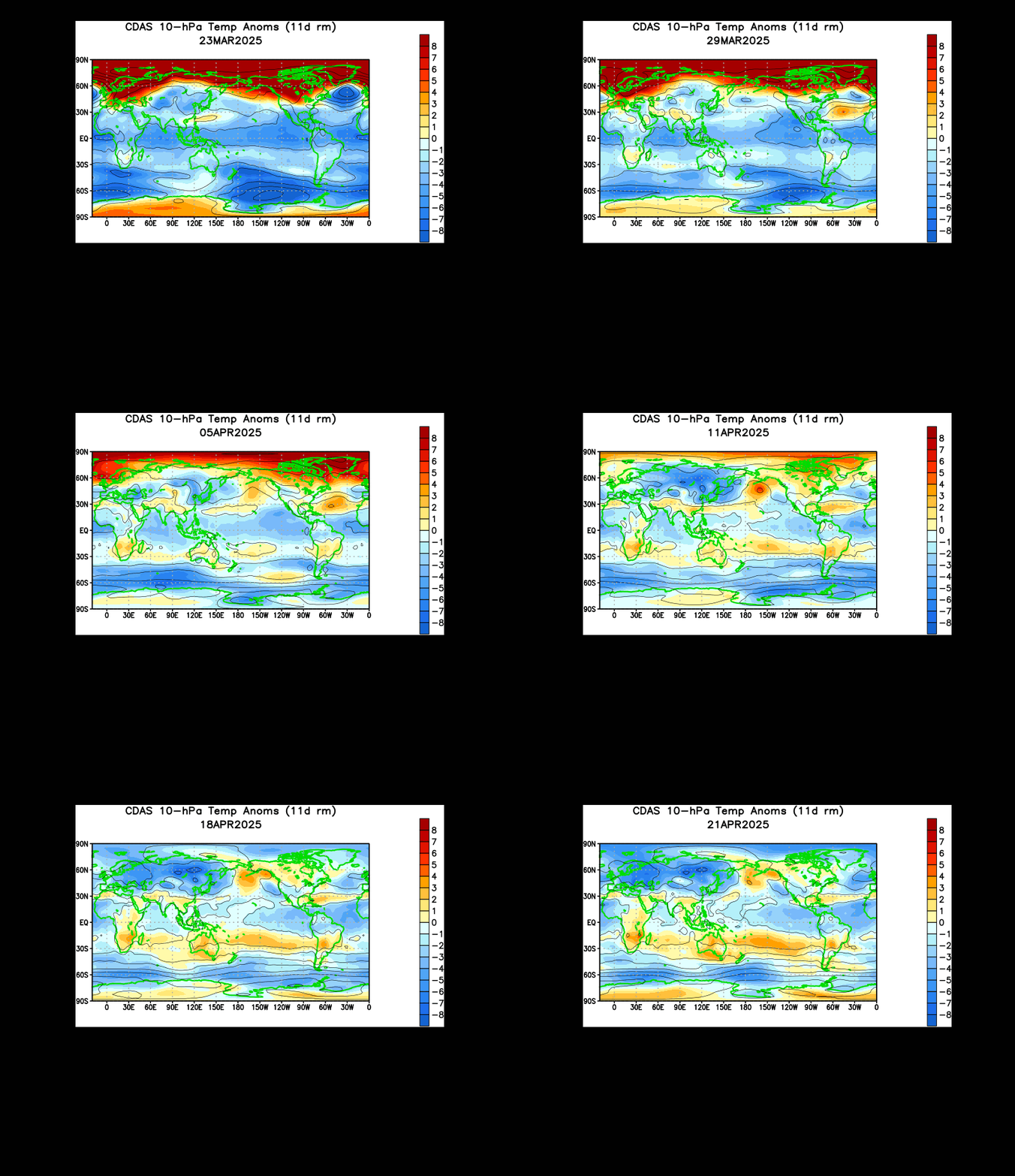
Shown above is an animation of 10 millibar temperature anomalies in the stratosphere. As I alluded to in my February 24th post, the Himalayan mountain range is a natural geographic instigator for these sudden stratospheric warmings. The enormous warming event we saw in January originated from the same mountain range we are now seeing this impending mass of warmth. Analyzing the above animation shows us that this warming event has been in the works since the beginning of February. In recent weeks towards mid and late February, we saw strengthening of this warming, and it became clear to me that this was not just a quick warming event. In my opinion, if you see a warming event over the Himalaya Mountains and it is sustained and strengthening, there's a solid chance that a sudden stratospheric warming could emerge from that situation.

The reason I am suddenly on what you may perceive as high alert is because of the last frame of this animation. If you look closely, you can see the pulse of warm temperature anomalies suddenly flare up over the Himalayan mountains, a sign of possibly sudden strengthening of this warming mass. This body of upper stratospheric warmth may very well be in its final stages of formation and the beginning stages of possible propagation to the Arctic, where the sudden stratospheric warming event could then take place. The warm air in the stratosphere would then push cold air down to the surface, and we could see that cold air hit the surface in the next 2-5 weeks, right around the start of severe weather season. If this cold air is able to come close to the US, or even penetrate through the nation, chances are the severe weather risk and winter weather risk would be heightened. I will explain more later on.

Andrew

March 6-8 Potential Nor'easter

Note: This will not be a full-blown Nor'easter.


Both major weather models are pointing towards a late-season partial Nor'easter that would be spit out of the Mid-Atlantic to dump snow in New England before moving out to sea.

Shown above is the European model's (top) forecast for mean sea level pressure about 7 days out. The bottom image shows mean sea level pressure and precipitation, again for 7 days out. Analysis of the two forecasts reveals that they are similar in both strength and placement of this storm. To have both major weather modeling systems in agreement at this point in time is certainly a good sign for those wanting snow in the Northeast and Mid-Atlantic.

With that agreement noted, I have opted to show the 48 hour accumulated snowfall forecast from Hour 156. We can clearly see a major hit of snow for Pennsylvania, New York and maybe a sliver of New Jersey, while coastal states are in the no-snow zone, as a typical Nor'easter will do. We see amounts exceeding one foot of snow, and these totals are centered in southern New York into eastern Pennsylvania. Major amounts of 6-12 inches are still found widely across New York and in the middle of Pennsylvania, as well as western Massachusetts and one or two other coastal states. Lower amounts below half a foot are found widely across the Northeast into the Mid-Atlantic.

Right now, such good model agreement is certainly a good sign for the above forecast to work out but we are still over 5 days away. That's a lot of time for things to change, and the system hasn't even gotten into the nation's upper air network, where the weather balloons can get data from the storm and put it into models to enhance forecasts.

Despite all the caveats, I feel confident in my call for all in the Northeast and Mid-Atlantic to keep one eye open on this system. It has good potential to bring heavy, wet snow to parts of the regions mentioned above, and must be monitored.

Andrew

March 4-6 Potential Winter Storm

Latest model forecasts are indicating the potential for a band of heavy snowfall to set up from the Plains into the Midwest and Ohio Valley during the timeframe of March 4-6.

Shown above is the snowfall forecast from the American model. It shows a corridor of heavy snow extending from Montana through the Plains and into the Midwest as a weakening trend hits. Some more enhanced totals are seen in southern Indiana and Ohio before the system transfers offshore of the East Coast, which is a post for another time. The snow would definitely be heaviest in the Plains as of current thinking, and these totals could very well exceed half a foot, with some spots reporting isolated totals very close to or just over one foot.

Contrary to the current belief, this system is not an Aberta Clipper. It is a regular storm system that happened to come onshore in Canada rather than the Pacific Northwest. Considering we remain a fair time out from this situation, and models are notorious for having issues with heavy snow in narrow corridors (as is to be expected), I think it is best to not make a preliminary map and instead cautiously go with the above snowfall forecast. This is not my forecast, but it does echo where I think the snows will fall. If models can show that they are rock solid with this heavy corridor of snow in the next 24 hours, I will most likely have a map out tomorrow.

Andrew