Showing posts with label Long Range Lookout. Show all posts

Friday, October 3, 2014

Long Range Lookout: Persistent Cold May Lead to Early-Season Snow

Upcoming spells of rather persistent cold may bring about the risk for some snowfall as we push into October.

CMC
The image above shows 500mb height contours from the Canadian model ensembles, valid about four days from today. In this graphic, we see a strong cold weather signal evolving over the United States. Suppressed ridging looks to form over the Western US, as the arcing motion of the contour lines show. Storminess over Alaska and western Canada look to keep a lid on that ridging, but we then see a body of strong ridging shooting up into Greenland, near the top-right corner of the graphic. It is this ridging that permits a strong upper level low to shift south from far northern Canada, buckling the jet stream south and allowing cold air to flow south into the United States. The depressed 500mb height contours confirm this proposition.

The potential for snow comes about from that stormy Gulf of Alaska, where pieces of energy may break off and surge into North America, possibly plummeting into the Plains and giving precipitation to the Central/East US.

CMC
Fast forward five days, now at the 9-day forecast window, and we still see a prevailing cold-weather signal from the CMC ensembles. Per the image above, the Canadian ensembles are expecting the strong ridging near Greenland to break down, eventually transitioning to zonal (not 'wavy', generally quiet weather) flow in the northern Atlantic. The West US now provokes this cold air potential, as that aforementioned suppressed ridging starts to build north into Canada. This change from a suppressed ridge to a building ridge is reflected well by the tilting of the depressed 500mb contours from east to west, giving the Upper Midwest and North Plains some chilly weather, sparing the East.

PSU
The cold weather signals continue, even out into the Day 14 outlook. The image above shows each individual member of the GFS ensemble system, and its forecasted temperature anomalies about 13 days from today over North America. The big panel at the top of this image shows the average temperature anomalies from all of these individual members, and per this average, we can see the slightly below-normal temperature anomalies pushing south from Canada, possibly continuing this pretty cold pattern we look to enter.

To summarize, a chilly pattern looks to envelop the United States in the next several days, persisting for a decent period of time. This cold may bring the risk for snowfall in areas where the cold air and any possible storm systems collide.

Andrew

Monday, September 22, 2014

Long Range Lookout: Warm End To September, Chilly Start To October

Model guidance is hinting at the idea of a warm end to October, before a chilly October opener enters the scene.

ECMWF
The two-panel image above shows 500mb height anomalies over North America on the left, with the spread among individual ensemble members on the right. For the image on the left, depressions of contour lines, as well as normalized standard deviations in the shaded areas. On the left panel, darker shades of purple indicate higher and higher uncertainty among ensemble members for what will happen in a given area.

According to the graphic above, valid September 28th, a strong trough looks to be pushing into the Western US, forcing high pressure to build in the Central and East US. Warm and dry weather can be expected from this event, while the West may experience its first period of cold and stormy weather in some time. This ridging of high pressure over the Central and Eastern US should allow for warmer than normal conditions to persist through the end of the month.

NAEFS
By the first week of October, the story changes. The image above shows another ensemble "spread" forecast over the 500mb level, now comprised of multiple North American model guidance systems, and now valid for October 1st. In this forecast, we see 500mb contours collapsing south over the Plains and Rockies, as this trough tries to push east. The ridge we discussed earlier is now weakened and suppressed to the south, as it begins to lose control of the Central and Eastern US.

While all of this is playing out, there's a very interesting story playing out in the Pacific. If we take a look at the northeast Pacific region, in the top-left part of this graphic, we see a large swath of yellows and reds, meaning high uncertainty over the area. The ensemble average for this area shows stormy weather in the Bering Sea, but those red colors mean not all ensemble members agree with this prognosis. The downstream effects of this uncertainty in the Pacific are shown in the Western US, as the stormy weather in the Bering Sea/Northeast Pacific produces high pressure over the Rockies, where some uncertainty is shown by the swath of green colors in that region.

To summarize, a warm end to September is expected, but model guidance is indicating a return to cold weather may be expected to kick off October, when a strong trough tries to push into the Central US.

Andrew

Friday, December 13, 2013

Long Range Lookout: Brutally Cold December Continues into January

New data I've compiled over the past few weeks leads me to believe that the end half of December and on into January will be filled with some pretty cold weather.

This data came as a result of analyzing the stratosphere, and determining the placement of temperature anomalies. Using a 2-4 week gap between warming and cooling air masses in the stratosphere, something I like to call the Stratospheric Temperature Index (STI) was created. 

For some verification, take a look at this text from a post I made on December 1st:


Between October 30 and the first few days of November, the Central and East US experienced above normal temperatures in the upper stratosphere. This is displayed well in the Climate Prediction Center's reanalysis of the 30th in the image above. These few days between the end of October and the start of November also included slightly above normal stratospheric temperatures diving south from Canada, with below normal temperatures observed in the Pacific Northwest. Because the effects of stratospheric warmings are typically seen 2-4 weeks after the warming event, we took a look at surface temperatures from November 14-28 to see how well the surface temperatures matched up with the upper stratospheric temperature anomalies (note that this is a negative correlation relationship, meaning above-normal stratospheric temperatures will lead to cold surface temperatures, and vice versa).
Ground-level temperature verification from November 14th to November 28th, approximately 2-4 weeks after the height of this US upper stratospheric warming event, is nearly identical to the temperature anomalies experienced in the stratosphere. The regions that saw above normal stratospheric temperatures, including the Central and East US, as well as Canada, saw below normal temperatures during this timeframe. Similarly, the Pacific Northwest, which was bathed in slightly below normal upper stratospheric temperatures to kick off November, was included in slightly above normal surface temperatures from November 14th to November 28th. It would seem to me that the stratosphere had a direct involvement with these surface temperature anomalies, given how well the stratospheric and surface temperature anomalies line up. (End Dec. 1 post.)

Get the gist? Above normal temperature anomalies tend to lead to below normal temperature anomalies, and vice versa. So now, let's take a look at what's happening here, with the most recent verification.


This image from the 10 millibar region in the stratosphere shows significant below normal temperature anomalies across much of Asia into the Northern Pacific, with above normal temperature anomalies stretching from the United States into Western Europe, with another swath of warm temperatures in East Asia on November 28th, 2013. Let's see how surface temperatures for December 7-10 are showing up, as the 2-4 week verification window from November 28th of December 14-28 is upon us.
It's no coincidence that we saw strong above normal temperatures across the North Pacific in response to those below normal stratospheric anomalies in late November. The warm stratosphere in the United States shows up as below normal temperature anomalies, fitting in to the STI's definition. Also, note how Western Europe shows up as below normal, and even a portion of East Asia getting in on the cold weather. Can you see how the index is verifying?

Now, take a look at this image of upper stratospheric temperature anomalies for December 7th. We see a strong body of above normal anomalies in the United States, as well as Central/Eastern Europe into East Asia. Significantly below normal anomalies are observed across Canada, the North Pacific and far northeast Asia. 

If we take that verification window from the late November warming (December 14-28), we can expect that timeframe to be colder than normal in the US. With the current warming intensifying in the image immediately above, we can now expect continued cold weather in the December 21-January 4. Depending on how long the warming in the United States lasts, we could continue to see cold weather well into January. It is tough to tell the intensity of the cold, but based on verification stats, it appears clear that the United States should see at least some cold weather.

Andrew

Tuesday, November 26, 2013

Long Range Lookout: Early-Mid December Looking Very Cold, Snowy

It's looking like early to mid December will be very cold, and quite possibly snowy across much of the nation.

Relative atmospheric angular momentum values for the last couple of months tell the story, as we have seen an emergence of positive AAM anomalies above the 60N latitude mark, as shown by the yellow blob near the top right part of the image. Without going into the technical aspect of the AAM, it is known that positive AAM anomalies above the 60N latitude line, with -AAM anomalies below that parallel can lead to favorable winter weather conditions across the country. In this case, a recent spike in AAM anomalies across the upper latitudes is now leading to the emergence of ridging near the Arctic, as I will show later on in this post. The -AAM anomalies persist across the mid-latitudes, confirming the suspicion that wintry weather will be here to stay for a little while.

Image created by Nicholas Schiraldi
The GFS Ensemble forecast for the AAM over the next couple of weeks reiterates the trend we have been seeing, with negative angular momentum anomalies keeping a tight grasp on the mid-latitudes in the days ahead. Positive AAM anomalies are projected to dissipate, but the aforementioned -AAM persistence in the mid-latitudes should keep at least a slightly wintry gun aimed at North America.

East Asia is projected to be rather stormy over the next handful of days into the latter part of early December. As I've mentioned on this blog, weather anomalies over East Asia have been found to affect weather in the United States 6 to 10 days after the occurrence in E. Asia. This means that when stormy weather hits Japan, it can be expected that stormy times will greet the US just 6-10 days later. The ECMWF ensemble system has been predicting that Japan will encounter some rough weather in the next couple of weeks and slightly beyond. This includes the passage of potentially several storm systems. If correct, this would greatly raise the possibility of snowy weather turning up in the United States just a few days later. It's a little too early to eye particular dates for this East Asian / US winter storm correlation, and it may be a little while before this stormy East Asian projection still holds value on the ensemble forecasts in a few days.

Now, this projected East Asian storminess will come as a massive shift in the Pacific gets underway. It is predicted that a huge ridge of high pressure will take up residence in Alaska and the Gulf of Alaska in the opening week of December. This ridge will then transition to an Omega Block pattern, which forms an atmospheric pattern not unlike that of the Greek letter Omega, as the illustration below shows.
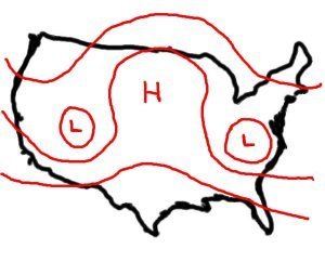
The Weather Prediction
This Omega Block in the Gulf of Alaska will really dominate the northern Pacific during its tenure in those waters. The ridge is expected to develop gradually until it finally bursts north and actually penetrates into the upper latitudes. With the presence of such a strong ridge, deep negative mid-level geopotential anomalies will develop in the Western US. This means that cold weather will be a prevailing feature for the West US into the Plains, as well as the Midwest, Great Lakes, Central and Southern Plains regions in conjunction with the teleconnection pattern, which we will discuss later.

Nearly a week after the ridge takes up residence in the Gulf of Alaska, the ECMWF ensemble prediction system (EPS) indicates the ridge will retrograde west and into the Bering Sea, still remaining in an Omega Block formation. This Bering Sea ridge may actually try to work out a Rex Block pattern with East Asia, where ridging in the Bering Sea may slide west further and provoke negative geopotential height anomalies across East Asia in typical Rex Block fashion. If that were to play out, East Asia would get pretty stormy, and as we discussed above, this would have stormy implications for the United States. However, because this is all long range in nature, I won't speculate too much on that potential. The ensemble set predicts that troughing will persist in the West US, and that would be a byproduct of another ridge popping up in the eastern Gulf of Alaska. This feature will determine if the Bering Sea ridge will transition to a Rex Block or remain an Omega Block. If it does go into a Rex Block, the ridge will slide westward, and the Gulf of Alaska ridge, should it be a separate entity, would allow troughing in the West US to continue- a bad sign for US winter weather folk. However, if it keeps its initial Omega Block form, ridging in the Gulf of Alaska should dissipate and instead be replaced by negative geopotential height anomalies. This would produce a favorable winter weather pattern for the US. This is all to be determined, and I'm not willing to go beyond analyzing the possibilities for diagnosing this particular situation.

Coming out of this massive ridging in the Pacific will be a very negative West Pacific Oscillation and East Pacific Oscillation, nicknamed the WPO and EPO respectfully. The two indices are very closely related, and they should react very similar when this Omega Block ridge begins to spread its influence across the Pacific. When that ridge forms, the WPO and EPO are likely to maintain their negative phase, as the negative phase of each index calls for ridging across the Pacific. The -WPO and -EPO also call for cold air to hit the West US, and then bleed east into the Plains and Midwest, before finally reaching the Mid-Atlantic/Northeast and Southeast. With the massive ridge in the Pacific producing the troughing in the west, it all looks primed for a textbook -WPO/-EPO response, with dramatic cold weather anomalies in the Plains that modify and push east with time. To summarize, this late November cold weather is only a sliver of what's to come.

Long range analogs created by the Climate Prediction Center and the GFS ensemble system confirm the idea that this Pacific ridge will create some very cold weather in the West US and the Plains, but also hint that it could set up some cross-polar flow for North America. What is cross-polar flow? When a ridge like the one we are discussing now sets up in the Pacific, it can shoot north and push the jet stream way north, even into the Arctic Circle. The jet stream carries cold Siberian air eastward as usual, but rather than send it towards the Bering Sea, the ridge in the northern Pacific bumps the jet stream north and then south, into North America. In a nutshell, a cross-polar flow event is the motherlode of cold weather, so to speak. If the analogs are true and the Pacific ridge can sustain itself at such a magnitude, then this cross-polar flow idea is a valid one in the long range.

Early and mid December is the prime target for some brutally cold weather, along with a side of snow potential. Just how cold and snowy it will get remains to be seen, but it's true: the potential is there.

Andrew

Wednesday, September 18, 2013

Long Range Lookout: Cool End of September, October Likely

It now appears the end of September and much of October will end up cooler than normal for multiple portions of the nation.

The European ensembles develop an Omega Block across much of Canada and far northern portions of the Plains. The Omega Block involves a body of high pressure being sandwiched between two areas of negative height anomalies. If you look closely at the height contours, you may be able to see what looks like the Greek letter Omega (Ω). The Omega Block pattern typically brings hot weather to those in the positive height anomaly region, and cool temperatures to those in the negative height anomalies. The Northeast, Ohio Valley and Plains will likely receive the negative height anomalies, while Canada and Greenland are inundated by positive height anomalies. Should this pattern stay in place for a prolonged period of time, it would not be impossible that we see a cooler than normal September over portions of the country that would be affected by this Omega Block. I do believe that it will be somewhat difficult to maintain this Omega Block, but I do not find it impossible that we see at least a form of a blocking pattern bring cool weather to parts of the United States.


This cool prognosis for September and October is supported further by CFS model projections of a negative North Atlantic Oscillation (bottom image) and negative Arctic Oscillation (top image). These two indexes are closely related, so it is no surprise to see these two going negative at the same time. It is epxected that the NAO and AO remain negative until at least October 10th, when the CFS starts to bring the two indexes to more neutral territory. But even in that situation, the CFS has lowered the projection from neutral to slightly negative in past model runs, which could mean we continue to see a negative AO and NAO past October 10th. Such a development would lead to a colder United States if the rest of the atmospheric pattern cooperates (indications are it would).

Andrew

Saturday, September 14, 2013

Long Range Lookout: Warmth Displaced North as Omega Block Evolves

The recent warm weather that many across the nation have experienced has ended for the next several days, as a new Omega Block pattern begins to set up over the northern part of the nation.

Shown above is the long range projection of 500 millibar height anomalies across the Northern Hemisphere from the American GFS Ensembles. This is valid around the September 26th period. On this forecast map, we see deep troughing along the western coast of Canada and into the Pacific Northwest. This provokes high pressure to develop in the Central US in a situation that would typically bring hot weather back to the nation. However, the body of high pressure will be displaced further north into Canada, which will spare much of the north central US from getting in on another hot spell. As long as the stormy pattern along the western North America coast continues, the threat of warmer weather easing into the US again is not out of the realm of possibility. I do not believe that the US will end up warmer than average in the next week or two due to this high pressure being displaced north, and those who sweated out several 90+ degree days in the last week will catch a well-deserved break.

The European ensemble set takes this idea of the heat being displaced north to another level, showing the evolution of an Omega Block across the United States and Canada. The Omega Block involves a body of high pressure being sandwiched between two areas of negative height anomalies. If you look closely at the height contours, you may be able to see what looks like the Greek letter Omega (Ω). The Omega Block pattern typically brings hot weather to those in the positive height anomaly region, and cool temperatures to those in the negative height anomalies. The Northeast, Ohio Valley and Plains will likely receive the negative height anomalies, while Canada and Greenland are inundated by positive height anomalies. Should this pattern stay in place for a prolonged period of time, it would not be impossible that we see a cooler than normal September over portions of the country that would be affected by this Omega Block.

Andrew

Saturday, September 7, 2013

Long Range Lookout: Rex Block in West Means Warmth for East

This is the first Long Range Lookout for the 2013-2014 fall, winter and early spring season. These posts will be issued each Wednesday afternoon, and if information arises that has a substantial effect on the long range, a special edition of the Long Range Lookout may be issued on the same day.

Long range ensembles are in agreement of a Rex Block setting up over the west coast of North America. The European ensemble set, shown above, projects negative height anomalies being positioned over the Pacific Northwest and southwestern Canada regions, with a corresponding positive height anomaly arising in northwest Canada and southeast Alaska. This is a classic example of a Rex Block, where negative height anomalies (low pressure) set up south of positive height anomalies (high pressure). To the east of this Rex Block, a few things can happen. If the low pressure system is angled correctly, negative height anomalies may stretch diagonally from the northeast of the low pressure system that is in the Rex Block. Another option is a zonal flow pattern, which means the jet stream is not wavy (in turn creating few opportunities for large-scale temperature anomaly patterns, negative or positive). The option we will most likely see in this situation is where the low pressure system in the Rex Block forces high pressure to set up downstream of the blocking pattern. In this case, the high pressure system would set up across south central Canada and the Great Lakes, as the ensemble set predicts above.


I expect this ridging pattern across south Canada and the Great Lakes to end roughly 3-5 days after it starts- this should not be a long-term event. The reasoning comes from an expected rising Pacific-North American index (PNA), which would allow for the departure of low pressure from the West, possibly shifting to the East. Remember that the negative PNA involves low pressure in the West and high pressure in the East, with the opposite true in a positive PNA. I have little doubt in my mind that the negative PNA we see in the projected teleconnection chart above is due to the negative height anomalies shown on the European ensembles image at the top of this post. On the right side of this image is the projected North Atlantic Oscillation over the next couple of weeks. The positive NAO pattern will be weakening to a neutral NAO, and could go to a negative NAO by the three week timeframe from today. The negative NAO encourages cooler conditions over the Central and East US, and the positive NAO we will be seeing in the next several days is a reason of why above normal temperatures are expected. The Rex Block pattern will not help matters.

Andrew

Thursday, January 31, 2013

Long Range Lookout: Winter Slipping Away

Preword: Recently, I have been caught up in the swing of the stratosphere and investing all of my confidence in just a few factors. Starting today, I will present the good and bad sides of the forecasted weather, even though you may not find it as exciting as my other posts.

In a disastrous recurrence of last winter, the winter of 2012-2013 has so far brought little snow and only modestly increased cold in comparison to last winter. Don't get me wrong, this winter has had many more advantages than last, but still remains dismal. The long range will be a classic, painstaking case of some factors looking good while other factors ruin the party. We start with the current 500 millibar anomalies over the Northern Hemisphere. Blues indicate low pressure areas and reds show high pressure regions. Deeper shades of each color indicate stronger modes of their respective pressure systems. We can see a deep blue positioned over the Great Lakes in the wake of a very powerful storm system that impacted much of the nation's population. This area of cold will move on out of the region later on as we head towards the weekend. I want to turn your attention to eastern Asia in the upper right-hand corner of the image. See that massive high pressure system there? That will provoke high pressure in the United States as we enter next week and into the following weekend, and we could see another bout of above normal temperatures. Snow cover that was received in the past couple of days could be eradicated. This comes at a time when high pressure finally emerges into the West Coast, a good sign for cold and snow in the Midwest and East US. But, as a result of the forecasted high pressure system, it will be Alberta clippers that bring the best chances for snow.

We now move ahead to Mid-February. There is no longer high pressure over East Asia, but persistant low pressure anomalies. These low pressure anomalies would then inspire a stormy period to round out the month of February. Could these storms hit the Northeast? I'll discuss that a bit later down this article. Something that certainly is not good is that persistant low pressure in the Bering Sea. This goes with my 'some good, some bad' forecast, as this persistant low pressure in the Bering Sea can lead to above normal temperatures in south-central Canada and much of the northern United States. Even more depressing is the lack of Greenland blocking. Greenland blocking is the phrase that is used to reference persistant high pressure over Greenland. When that set-up happens, the atmospheric pattern is more inclined to introduce more wintry weather into parts of the US. A lack of this blocking leads to a more zonal, west-to-east jet stream that allows for warm temperatures and not many storms. It is very possible some of that high latitude blocking in eastern Europe (shown in deep reds) could migrate over to Europe, but that remains to be seen. Frankly, I'm not that optimistic on the idea. This dismal explanation is verified by slight high pressure in the New England area, likely as a byproduct of the low pressure in the Bering Sea, and in response to a lack of Greenland Blocking. One bit of good news is the forecasted high pressure over the Pacific Northwest. If you get high pressure in that area, the jet stream can be persuaded to dip south and let out some cold into the Northern US. Storms tend to follow a jet stream that favors wintry weather for those same regions, the Midwest and Ohio Valley for example.

Lastly, looking ahead to the heart of February just a few days after the above image, we find that the atmosphere has changed. That high pressure that was in the Pacific Northwest has now migrated into the Gulf of Alaska. This situation can then go one of two ways. The first option is for high pressure to then spread back on land into the Pacific Northwest, or the high pressure pushes west into the Bering Sea. Both moves would support a cooler pattern in the North US, but I'm not betting on it at the moment, as the consensus is not overwhelming and we are over 2 weeks away from this forecast image. We still see persistant low pressure in East Asia, adding to my theory of a stormy end to February. Also, we then see the forecast emerging for some spotty patches of high pressure in and around Greenland. Such an action could provoke a better pattern for the Northeast (notice the high pressure in New England is gone), but it's too far out for me to think about accepting or rejecting this idea.

So we could see some storms in late February, but the big story will be warmth in mid-February, with Alberta Clippers dominating that scene. Early February will be when the effects from the sudden stratospheric warming dies off, so that will add to the troubles the cold may face in the coming month.

Andrew

Thursday, December 6, 2012

Long Range Lookout: Stormy Pattern Ahead, Cold Lacking


A much stormier pattern looks to be emerging in the next week or two, but persistent cold weather will be lacking.

The above image is today's new 12z ECMWF model forecast at hour 240, or 10 days away. The colors are shown on the legend on the right as 500mb height anomalies. Cooler colors show below normal heights (stormy trend), and warmer colors depict a quieter pattern with above normal heights. Let's dissect the areas of interest I marked off.

1 - Negative PNA

This is usually something that would drive many in the East US up the wall as far as cold and snow potentials being ruined. However, this negative PNA looks like it will come in a more bursting form. What multiple models are showing is that several storms will break off of the original Gulf of Alaska trough and move south, into the West Coast. Typically, they would stick around and hold the negative PNA pattern. However, this regime should incite pieces of energy (strong pieces at that) to move east and actually bring big chances for snow and storms to the central and east US. The question is, where will these storms tend to go?

2 - East Based Negative NAO

We've all heard of the negative North Atlantic Oscillation (NAO) and how it brings cold and snow to the Northeast when it is in this phase. However, exactly where the ridge in Greenland is based is key. The ridge in Greenland is the base of the negative NAO. However, if it is west of Greenland, we call it 'west based'. West Based negative NAO's tend to favor the East Coast for all the cold and snow. If that ridge of high pressure is east of Greenland, we refer to the NAO as 'east based'. In the east-based negative NAO, the Plains and Midwest benefit the most from the storms and cold. If we take a gander at the above ECMWF forecast, it's apparent that we have an east-based (possibly back and forth with west-based) negative NAO. If we then follow up with our negative PNA and its storm train, I would think that the Plains and possibly the Midwest would get in on some stormy action. Precipitation type is a little harder to determine.

3 - Frequent East US Ridging

The reason this isn't a perfect storm with the negative PNA / negative NAO is because of how the negative PNA really works. Due to a depression in heights in the West, physics dictates that we would see an above normal height anomaly (high pressure tendency) to develop in the East. Now, because the storm train that the negative PNA looks to create, these ridges will not be in place for days and days- they should be off and on, depending on when the storms come through. However, this off-and-on solution shows that any snow that sticks in any place will not be welcome to stay for a long period of time.

Looking at the longer range GEFS Control run (a member of the ensembles, but its parameters are unchanged, unlike other ensemble members), we see the negative NAO still struggling to determine whether it's east or west based, and our negative PNA continuing to blast energy into the West.

Something I think should be monitored, however, is the combination of a -PNA, -NAO and -AO. The -AO and -NAO would theoretically open the floodgates for cold, but that negative PNA puts a stop to it reaching the East. That said, I anticipate the cold to stay in Canada and the Northern Plains. The Dakotas, Minnesota, Montana and the like could get in on some of the cold action, but that's about it for the short term.

Despite this GEFS Control forecast, it is essentially one run of the GFS- not worth much on its own. That said, take this forecast for what it's worth. I personally believe the ECMWF has a good forecast going (it has verified well in recent months), and we should see some clarity in the models in coming days.

Andrew

Friday, November 16, 2012

Special Long Range Lookout: Pattern Turning Favorable For Cold, Snow

This is a Special Long Range Lookout, published November 16, 2012.

Colder weather looks to be coming back in the not-so-distant future. The North Atlantic Oscillation (NAO) forecast on the left includes the black line of observed conditions and the red ensemble forecast members for the NAO. In a positive NAO, warm conditions are typically seen across the eastern US, while a negative NAO causes the jet stream to buckle south, usually into the Northeast. This results in an outbreak of cold air over the region. Storms that skirt the Gulf Coast also are pulled north and can turn into the famous Nor'easters.

The NAO is looking pretty negative over the next couple of weeks. While more recent forecasts are trending more positive, the GFS Ensembles have been very consistent with a strong negative NAO developing. This comes as East Asia indicates a stormy period is in store for the Northeast in the near future, aiding the -NAO potential.

The second image here on the left is the forecast for the Arctic Oscillation, or AO. The AO also has two phases: positive and negative. The NAO and AO are closely related in that both indices' positive phases involve warmth over much of the nation. Their negative phases also induce cold across the nation, more-so with the AO than the NAO, which is more influential in the Northeast than the AO. The ensemble forecast members, while varying in the long range, appear to be showing a fair negative trend in the long range.

Considering the consistency of the GFS Ensembles, East Asian signals and a few other significant factors, the Arctic Oscillation is likely to be heading on a more negative track in coming days. I find the presence of a negative NAO inviting to the potential of a negative Arctic Oscillation as well.

As for the Pacific-North American index, or PNA index, the outlook is not as favorable. Just like the NAO and AO, the PNA has a positive and negative phase, although they are much different than the effects from the NAO/AO. In a positive PNA, you will see an active storm track in the Plains, Midwest, Great Lakes and Ohio Valley, with cold air in those same regions. The Northeast is also affected. However, in a negative PNA, warm air is more common, and the storm track tends to stay away from these areas.

The persistent trough currently in place over the northeast Pacific is helping to keep the PNA negative, and the forecast ensemble members seem to have no trouble agreeing with this pattern continuing. Despite this, I believe that this persistent trough pattern will break in mid December.

Andrew

Wednesday, November 7, 2012

Long Range Lookout: November Lost to Warmth

I believe that November is, unfortunately, lost as far as winter potential goes, as a poorly-timed Rossby Wave train begins to set in for November.

Hour 204

Hour 384
The Rossby Wave train is a 'train' of storm systems pushing southwest from the North Pole. What happens in response to storm systems pushing in the West? If you guessed a warm East US, you are correct. Hour 204 from November 6th's latest GFS Ensembles shows that scenario.

Rossby Wave trains typically have a full cycle in which 3 stages occur. Stage 1 involves the pattern in a dormant state, not really doing much. Stage 2 is when you start to pick up on some storm systems hitting the same area over a period of time. Stage 3 is the full-blown active stage, as is forecasted in Hour 204 and 384. These three stages usually happen within a 4-6 week cycle, so it's no surprise that the farthest GFS Ensemble forecasts still show the Rossby waves in action.

Because this will be developing in early November, we can expect this poorly-timed pattern to last through November, likely ending in early December at the earliest and mid-December at the latest.

But don't lose hope!

I have been tracking this Rossby wave train for a while now. If I extrapolate (use observations in a forecast) this Rossby wave train will progress into the North Pacific. In response, the high pressure tendencies will be placed over the West, leading to a much stormier, colder pattern for the East. Couple that with favorable late-winter signals from Siberia in October and it looks like we could have a more back-loaded winter coming up.

Andrew

Sunday, November 4, 2012

Special Long Range Lookout: Dreaded Eastern Ridge Showing Up

This is a Special Long Range Lookout, published November 4, 2012.

The dreaded Eastern US ridge pattern is showing up in the ensembles in the next 5-10 day timeframe. As a stormy pattern begins to shift westward into the Southwest and general Western US, and the environment around Greenland begins to become more stormy, a ridge of high pressure will be setting up across the eastern US in response to these two factors. The stormy West will be a negative Pacific-North American (PNA) pattern, which brings about a warmer pattern in the East. The stormy Greenland area will be a positive North Atlantic Oscillation (NAO), which helps a warming trend across the East. While this detrimental negative PNA will be quite strong, the positive NAO will be relatively weak, which means this won't be a locked-up warm pattern.

If this were winter, many in the East would be in some trouble. However, I can see that this is, in no way, the end of winter before its even started. Let's take a trip up to the Arctic. In the Arctic, we see a disorganized bunch of reds (high pressure) and blues (storm systems). This is good. If we have the ridges of high pressure holding their ground in the Arctic, it will ensure the prevention of a polar vortex forming. A polar vortex is the base of the Arctic Oscillation (AO), which is strong in the positive phase (cold air is locked up north, warm air prevails in the US) and weak in the negative phase (polar vortex breaks, cold air flows south).

Last winter, we had the polar vortex present and strong, which kept the cold air north in Canada and Alaska. Rarely did a ridge break in to that vortex that kicked cold air south. This fall, we have been observing a relatively quiet Arctic with the absence of the polar vortex, which is a good sign for this winter. While a ridge in the East may not be the best thing we want to see as we come in to the final days of fall, the absence of a polar vortex and the presence of at least one big ridge in the Arctic is certainly good news, and a welcome change from what we saw last winter.

In summary, the East is likely to see a few warm-ups in the next few weeks. However, the fact that the NAO will not be a strong positive and there is no polar vortex present is very good news in my eyes, especially the weakness of the positive NAO in the short term. If the +NAO remains weak, then the ridges in the East will be easily pushed off. Now, due to the strong negative PNA they will form again, but the ridge is unlikely to be sustained for longer than 3-6 days at a time thanks to the weak +NAO.

The people most likely to see snow in the next week or two will definitely be the Plains and Rockies, as the stormy pattern persists in that region.

Andrew

Wednesday, October 31, 2012

Long Range Lookout: Stormy Pattern Continues in Northeast

This is the October 31, 2012 edition of Long Range Lookout.

After the devastation Superstorm Sandy caused across the Northeast, many are likely to be wary when I say that a general stormy pattern looks to take hold across the region. The ECMWF ensembles, shown above in a 500mb height anomaly chart for the next 6-10 day period, shows a ridge building across the West and a stormy signature in the East.

This is shown in model forecasts as coming in at least two systems, which could both hold the potential for some flying snowflakes, however that has yet to be nailed down as a possibility.

Something that is puzzling to me is the lack of a clear negative NAO signature, something that commonly defines a stormy Northeast period. Instead, Greenland seems to be in between a ridge in the south and a stormy pattern to the north. Additionally, other ensemble forecasts are playing out a positive PNA heading negative and a negative NAO heading positive, both of which bode well for a storm track away from the Northeast.

Despite these unknown elements, I believe that the ECMWF Ensembles are on track with this forecast, as other models are showing very similar conditions to the scenario depicted above.

Andrew

Tuesday, October 23, 2012

Long Range Lookout: ECMWF Late Fall-Early Winter 2012 Forecast

This is the ECMWF's Late Fall-Early Winter 2012 Forecast as interpreted by The Weather Centre. I will not provide the actual image out of copyright concerns.

The ECMWF's climate model is projecting a big swath of the Plains, Midwest and Rockies to be in a slightly cooler than normal state in this timeframe. No frigid temperature anomalies are expected to arise, although such a potential would be maximized in the Southwest states (New Mexico into Arizona). The Northeast and Southwest are portrayed as areas with above normal temperatures, the Northeast bearing the warmer brunt of the two.

As for precipitation, the ECMWF cites a below normal precipitation area across the meeting ground between the Northwest and Southwest. A chance of below normal precipitation is forecasted across parts of the Gulf Coast, but other than that, the ECMWF is relatively not concerned with the rest of the nation as far as precipitation anomalies go.

Keep in mind these forecasts are from one model of at least a few dozen- one fish in a never-ending sea, so to speak. So don't lose all hope just because one model says little precipitation is forecasted.

Andrew

Friday, October 19, 2012

Special Long Range Lookout: Strong Greenland Block Setting Up

This is a Special Long Range Lookout, made and published on October 19, 2012.

I am monitoring the potential for a very strong Greenland Block to emerge in the next several weeks, as the pattern continues to slip further into a more winterized pattern. But before we get into this potentially significant development, let's review what the Greenland Block is.

The Greenland Block refers to a semi-permanent high pressure system over Greenland. That means that there is a tendency for a high pressure system to form over Greenland repeatedly. This 'Block' in the term Greenland Block is for what happens to the atmosphere when this phenomena hits. The high pressure system develops over Greenland and blocks the atmosphere's traffic of disturbances and ridges from progressing around the world, 'blocking' these systems. The Greenland Block is associated with the North Atlantic Oscillation's negative phase. In the NAO negative phase, this block encourages a stormy and cold pattern to emerge over the eastern US.

The chart above is depicting 500mb height anomalies in the 10-11 day forecast range. While many more 'informed' weather folk may know that such long range forecasts have a high chance to fail, this particular image is composed of the 12z GFS Ensemble members averaged out. This significantly strengthen's its argument. The forecast is calling for a very strong Greenland Block to develop over Greenland. At the moment, this would most likely be borderline East Based, which typically benefits the Midwest and Great Lakes for snow and cold.

The GFS Ensembles are shown here individually, with blue areas defining disturbances and red areas showing high pressure. The deeper the color, the stronger its respective atmospheric apparatus is. These ensembles are also valid for the 10-11 day forecast, and are all in unusually good agreement with a strong Greenland Block and stormy pattern over the US. The unusual high confidence in these ensembles leads me to believe one thing...

Winter is being revealed.

Think about it. This whole month, the eastern US has been hit by strong systems, with many areas being above normal in precipitation. If this stormy pattern continues through the month of October, trends show that fall patterns correlate with winter patterns. Thus, such a stormy pattern now may very well induce a stormy winter for the East US. And yes, the LRC does factor in here.

Andrew

Wednesday, October 17, 2012

Long Range Lookout: Pattern About To Get Dicey

This is the October 17, 2012 edition of Long Range Lookout.

This weather pattern is about to get a whole lot... warmer. Yes, warmer. Above, you can see the 500mb height anomalies on the left, and the GFS Ensemble 'spaghetti' forecast on the right for approximately 6 days away.

The right image is composed of 500mb height forecasts from each member of the GFS Ensembles. When you combine them into one image like the one seen above, the result is a very messy picture (especially in the long range). These twisting, turning lines are what gives the right image the nickname 'spaghetti model' forecast. On the left is the 500mb height anomalies from the ensembles on the right. The 500mb layer is considered the best to look for high and low pressure systems. Blue areas are stormy areas, and red spots are composed of high pressure anomalies. The darker each color is, the stronger its respective apparatus is.

This forecast is showing a strong high pressure stretching across the heavy majority of Canada, including near Greenland, the focus point of the North Atlantic Oscillation (NAO). When you get a ridge like this near Greenland, a negative NAO develops, which can bring cold and snow to the East US in the wintertime. However, check out that deep blue area over the northeast Pacific and western US. That is a very strong negative PNA pattern. In a negative PNA, a deep disturbance locks up the West Coast, and a ridge of high pressure develops in the East US in response. This, in turn, hampers cold and snow efforts to reach the US.

So, over the next week or two, expect a warm up to enter the playing field. This warm up looks to be short-lived before a big cool down enters the States, but that will be on a separate post.

Remember, you can catch Long Range Lookout every Wednesday, here on The Weather Centre.

Andrew

Tuesday, October 9, 2012

Long Range Lookout: Very Active Pattern Setting Up

Hour 228 of 12z October 8 Ensembles

Hour 324 of 12z October 8 Ensembles
This is your weekly edition of Long Range Lookout, published October 10.

The ensembles from October 8th (when this post was made) are all showing very strong storms in the long range affecting the United States. While they all have very different scenarios, let me tell you why you should take notice.

You should know if you are an avid weather person that models have trends, i.e. forecasting a heat wave for the last 5 days. Well, ensembles have a similar 'rule'. A general rule of thumb for ensembles is to look for a general pattern. If we look at the ensembles above, we can definitely see that they are all very different, so one would think there is no pattern. However, we aren't looking for a specific storm- we are looking for something they all have in common. A reanalysis of these images reveals that the ensembles all have strong storm systems in their forecasts, meaning we have a pattern.

Seeing as the ensembles are forecasting at least two unusually strong storm systems to come through, one would think that there is some evidence to back this possibility up. However, models have been known to drastically overestimate storms over the ocean. Models typically have a tough time with systems not on North American land, where more data on the system can be gathered.

In conclusion, the next 7-14 days and beyond are looking unusually active. I would not be surprised to see two or more unusually strong storms hit the West Coast and produce severe weather on one side of a frontal boundary and a blizzard on the other side when it moves into the Central and Eastern US.

The North Atlantic Oscillation, or NAO, also looks to be taking a dive, clearing the way for some cold in the Northeast. But that's not all- the Arctic Oscillation (AO) may also plummet as a ridge forms over the North Pole.

The NAO and AO are both oscillations that bring cold to the nation in a negative phase (ridge over Greenland for NAO, ridge over Arctic Circle for AO) and supply warmth to the nation in a positive phase (stormy over Greenland for NAO, stormy over Arctic Circle for AO). This ridge formation over Greenland and the North Pole should create a double-whammy, where some chilly weather should enter the nation. Also, take note of the ridge over the northeast Pacific. This symbolizes a positive PNA, which means more cold and storms for the central and east regions of the country.

Things are looking up, snow lovers!

Andrew

Wednesday, October 3, 2012

Long Range Lookout: Cold and Snowy Pattern Settling In

This is the October 3, 2012 issue of Long Range Lookout. Further Long Range Lookout posts will now be issued on Wednesday afternoons.

This is an analysis image of what was observed on September 22, 2012. This chart shows 500mb height anomalies across North America and the East Pacific. As you can see, a deep disturbance was present in the Great Lakes region, with a strong ridge in northwestern North America. Look familiar? It should feel familiar, as this disturbance brought many North US folks the first good cold shot as a result of this synoptic-scale pattern. It even brought some snow to the Upper Midwest. It was a total shock to many folks, who usually see their first freeze well into October. Snow fell several weeks before it should.

What we have been seeing no longer appears to be an anomaly. Cold across the board and snow in the Upper Midwest may actually be the norm if what I'm about to show you verifies.

This is the 240 hour forecast for the latest GFS model. I have outlined two areas of interest- the first is an arrow pointing east, denoting an active storm track. This is not something new- we have been seeing this active North Pacific storm track for quite a while now, and it is these systems that have produced the cold in the North.

Also, take note of the circled area of blues out ahead of the storm systems. It is known that before a storm system moves east into the West Coast of North America, a ridge can form out ahead and force the storm to change its path. Again, this has happened several times in the past few weeks. If this ridge holds, the storms will shoot north and dive south into the Great Lakes, sending cold and snow into the region, like we have seen earlier.

My point is, the cold is going to stick around in the next several days before a possible steady warm up occurs through much of the nation. However, this has yet to be examined and must be analyzed further to confirm this suspicion.

Andrew

Sunday, September 23, 2012

Special Long Range Lookout: Sustained Cold In Long Range

This is a special edition of 'Long Range Lookout', being presented after the 12z GFS brings unseasonably cold air to much of the north and west parts of the nation.

As seen above, the 11-15 day average for 850mb temperature anomalies is very cold- as low as 14 degrees below normal. This actually puts the 850mb temperatures cold enough to produce snow- an occurrence being shown by the same 12z GFS.

As is to be expected, the long range verifies a very small part of the time, so one would usually take this with a grain of salt. However, looking at past trends of the last few runs of the GFS focused on 11-15 day 850mb temp anomalies, the model has been steadily trending colder with each run. What I would take away from this is that an enhanced appearance of cold weather is likely in the next couple of weeks, but the intensity is unknown.

Also of interest is the 11-15 day 500mb height anomalies. Notice the strong signs of a positive PNA, with a strong ridge in eastern Alaska and western Canada. However, the lack of a ridge near Greenland will result in an obstacle of being able to get the cold air east.

Considering there is a strong disturbance anomaly over south central Canada and central Canada, there should be at least one storm system that sweeps cold air east and into the Midwest and Mississippi Valley. The west-to-east motion of systems in the North Hemisphere means that this cold air will eventually move east into the eastern US, but the intensity of that cold air is in question.

Andrew

Saturday, September 22, 2012

Long Range Lookout: Active North US Pattern To Continue

In this week's 'Long Range Lookout' segment, we'll examine what propsects the already-active fall season for the North US has for continuing into the next few weeks.

This is an ensemble forecast for the East Pacific Oscillation, or EPO. In a positive EPO, we see a strong trough centered over the Gulf of Alaska, with a ridge of high pressure extending west from Baja California and stretching across much of the Pacific. Additionally, a cold north US is a common trait of a negative EPO.

Recently, the EPO has been in a negative state, and this has been shown by the appearance of a strong trough over the Gulf of Alaska and cool temperatures across the northern US. This bodes well with typical negative EPO conditions. I will explain how this plays into a bigger pattern in a little bit.

We are also watching the Pacific-North American Pattern, or PNA pattern. In a positive state, the PNA creates a strong ridge over eastern Alaska and much of western Canada. This ridge enables storms to jump over the ridge, plummet down towards the Southwest, and follow the jet stream into the southern Plains. From there, the storms take a path that bodes well for high precipitation across the Midwest, Ohio Valley, and Great Lakes.

In the most recent week, we have had a positive PNA. This has been well reflected by the presence of a strong ridge in northwestern North America. Storm systems have been hitting the Ohio Valley and Midwest at a fair pace as well, illustrating the effects of the positive PNA.

Now, both of the above indices can (and did) mix together. The two combined to produce a ridge in the West, and a stormy pattern in the East, as illustrated below. This chart was from September 20th.

University at Albany
If the ensemble forecasts from above do verify, we could again see strong storm systems hitting the North US and bringing very cold air down to the region. This also includes the risk of some severe weather in the Northeast, as cold air moves in on warmer air brought up by warm fronts. This could also be a crucial sign of the incoming new Lezak Recurring Cycle. Every little change could mean something bigger later on.

Andrew